California to Texas

The friendliest place on the web for anyone with an RV or an interest in RVing!
If you have answers, please help by responding to the unanswered posts.

muskoka guy

Well-known member
Joined
Oct 15, 2012
Posts
1,114
Location
MUSKOKA ONTARIO
We will be flying to Kelowna Bc to hook up with our friends in their 40 ft dp. in early February.We will have a toad in tow.  We plan on hammering  down to get to California and the nicer weather. Will check out the big trees in  Redwood National park. Plan on taking portions of the pacific coast highway. Maybe head to the coast at Grants Pass. Next major stop is San Francisco as well as  Yosimite NP. Carry on down the coast past Big Sur to maybe Santa Barbara. Want to check out Sequoia NP as well. We are going to skip LA and southern California and head for Vegas. Maybe a day in Vegas or so then hit the Hoover dam on route to the south rim of the grand canyon. If we have time we might head to Page and check out the slot canyons and the Glen Canyon dam and possibly slip over to Utah to the monument valley. Heading south from there we will travel to Sedona from Flagstaff which is supposed to be a scenic drive as well. Other than a stop at the Carlsbad caverns New Mexico  we will probably head straight to Houston Texas to meet up with our other friends who drove their rv down at Christmas. Whatever time we have left we will spend on the gulf coast possibly take in a bit of marti gras.  We will then  all drive back to Ontario just north of Toronto .In total we have just under a month from leaving Kelowna till we have to be back in Ontario. Dont plan on  stopping much on the way home due to the cold weather. Am thinking close to two weeks to get down to Texas, and have close to two weeks down south. We can drive straight home in just over a day. I know this sounds like a lot of driving but we have several drivers and want to skip past the cold weather on the way down and the way back north. Any thoughts or suggestions would be appreciated. thx
 
i hope you have looked at a map as your california itinerary has you criss crossing the state several times.
in February you will probably be in snow in yosemite and sequoia and a very good chance in flagstaff.
if you add up all the miles you plan to drive there will be very little time to see the sights and will be very stressful trip with two families in one m.h. with all work and no play
 
I'm confused...you say you can drive home in a day from Texas or New Orleans. That should be an interesting day... Hope you don't hit snow. 
 
It does seam to be a little overly ambitious trip in that time frame. Why go to all the trouble if you don't have the time to enjoy the things you are going to see.
Let us know how long it realey took you to drive from Houston to North of Toronto. Even using different drivers in a marathon drive I am forecasting about 35 hours.
Good luck
Bill
 
If you're planning to do this soon, weather will be a huge factor, especially in the mountains and high passes in the Sierras and even LV's in the winter can get dicey.  Flagstaff is notorious for blizzards at 6-7,000 ft.  Monument Valley as well.  Page is dead in the winter and often cold.  Driving from Sedona to Carlsbad, probably 7-800 miles and you probably want to get down to I-10 anyway...Yuma, Phx, Tucson, El Paso, etc.  You can do all this but if it were me, I'd downsize to fewer places with a little more time at each one you choose.  Getting further south would keep the temperatures up.  Whatever, have a great trip. 
 
Thanks for the replies. When we leave for Toronto we will probably be at Nashville. I believe it is only about 14 hrs from there to Toronto. Maybe we will skip Page but we would like to see the Grand Canyon. Being from Canada I dont really travel south in the summer, so these destinations in the summer with have to wait for retirement when i have more time available .  Nice to escape the snow. Our plans are to drive to Texas, which if we take two weeks to get there, it  shouldnt be that radical of a drive. Then we have two weeks to cruise around the gulf coast then head home. I agree it will be more driving than sightseeing, but we have a few drivers. Appreciate the input. If any of those destinations you would for sure rule out due to winter conditions, please advise as we are completely flexible. I work in constuction and can seldom ever get much time off in the summer. Thx
 
      Do not underestimate the dangers of snow at high elevation.  We have crossed the Sierras just north of Yosemite in early June, and they had had a major snowfall the previous week, there were banks over 10 feet high.  Similarly, we hit snow mid November at the Grand Canyon and Flagstaff.  State Troopers were checking to ensure you have chains installed prior to allowing you onto the interstate.
    You may be used to snow being from a snowbelt, but many around you may have never driven in snow, and thus be a danger to you.  Remember snow removal may not be up to the standards that you are used to.
      Do what you think is safe, but I would follow the previous advice, stay away from elevation, and stay as far south as you can.

Ed
 
Great advice. thx We are towing a  car. Perhaps we can leave the coach at a lower elevation and proceed to the higher spots only if the weather looks favorable and the forcast is good. Will see where the elevation changes and plan accordingly.
 
What elevation would you typically start to find snow in the mountains. Im assuming if we stay closer to the pacific ocean going down we will avoid the snow once we get far enough south, which would be where? Oregon?
 
We're at 538 feet elevation in Oregon and right now it is snowing -- not sticking yet, but will later tonight.  My brother at this very time is traveling from Sisters back to Eugene.  The pictures his wife posted looked scary to me.  Check the weather, get off the road when you need to, and  stay safe.  Oregon is not exactly "south" for winter weather planning.
 
Thx Thats why we would rather head right down to California. We get plenty of winter here. Trying to get away from winter. Plan is to meet our friends in Texas and were hoping to see a few sights on route. I am sure we wont be driving the coach sightseeing but were hoping if possible to take the car for a few side trips on the way down. Thanks for any advise. It sure helps in the planning. Might save a few mistakes by planning ahead. Cheers
 
    Given the time of the year, I would advise heading straight down to Southern California, then across I 8 to I 10, and do your touristing in the warmth of that area.  It may not be a dramatic as Yosemite or the Grand Canyon, but there are a lot of great places to see.  We wintered in Yuma one year and the lower desert is like nothing we have in Canada, or a couple of days in Tombstone of Bisbee are unique.  I'd even stay away from I 40, as we were storm stayed in Tucumcary in late November for a couple of days due to a snow storm with a multiple semi truck incident that closed it down.
    San Antonio has the Alamo, a few days at the beaches of the Padre Islands, and lots more that you can do while staying warm and safe.
  As for when or where are the elevations to satay away from, these are the west coast mountain ridges.  They go from 52 feet sea level to over 4,000 feet here is a link:  http://www.interstate-guide.com/i-008.html  It is far enough south that it virtually never gets snow, it has happened.


  Ed
 
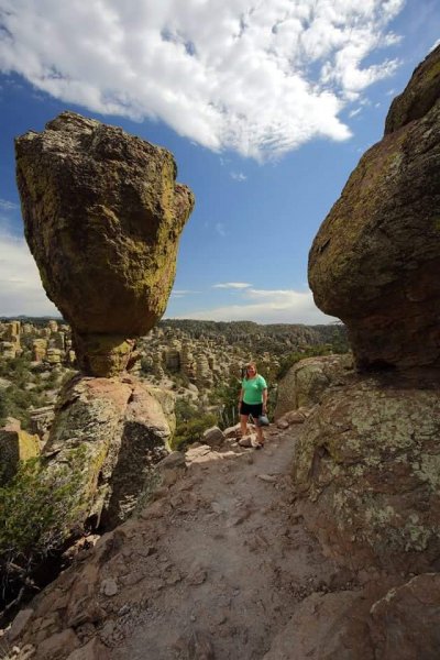
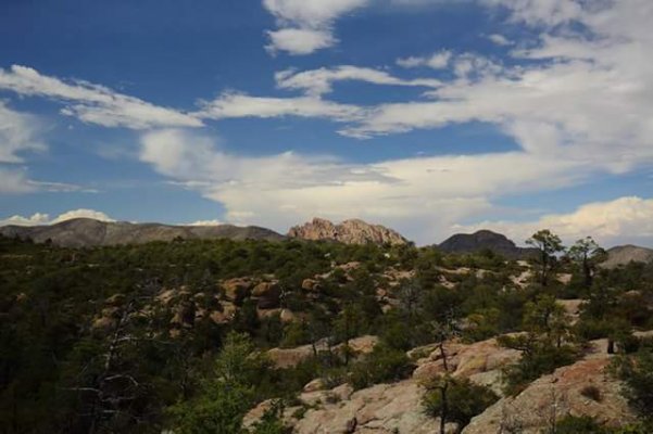
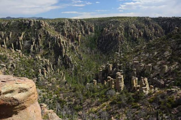
Bisbee is interesting, if you go there do the Lavender Jeep tour, leaves from Copper Queen Hotel I think. Lots of local history and info. Also visit Chiracahua National Monument, beautiful place. Not too far to drive and some fairly easy walks.

Photos of the monument, look for the head of Cochise lying down....
 

Attachments

  • FB_IMG_1483366689530.jpg
    FB_IMG_1483366689530.jpg
    78.7 KB · Views: 9
  • FB_IMG_1483366705500.jpg
    FB_IMG_1483366705500.jpg
    29.5 KB · Views: 7
  • FB_IMG_1483366722163.jpg
    FB_IMG_1483366722163.jpg
    16.8 KB · Views: 8
  • FB_IMG_1483366675850.jpg
    FB_IMG_1483366675850.jpg
    49.1 KB · Views: 9
If you travel as planned, you will need chains on many of the passes, and I am talking interstates.
 
I have downloaded all the elevations for the areas we planned on going. For sure didnt realize flagstaff was so high up even being on an interstate. We have highways like that in bc that require chains to proceed. I think i will rework my plans and plan on leaving the mh at lower elevations and depended on the weather forecast, delete certain stops or if possible take the car for a day trip. Thx again. The info really helps.
 
Elevation can sometimes be deceiving.  The Siskiyou Summit on I-5 between Ashland, Oregon and Yreka, CA is only 4,310 feet but is often closed during winter due to snow and ice. 
 
Thx Tom and Margi. Are you familiar with Grants pass to Cresent City. I this a viable option in the winter or is that not a good idea.
 
Haven't been over that road for years.  Easier passes to/from the coast are Drain to Elkton to Reedsport, Sutherlin to Reedsport, and south of Roseburg to Coos Bay (tho I'm not fond of that one for some reason).  I found a discussion of the route from Crescent City to Grants Pass on this site:

https://www.tripadvisor.com/ShowTopic-g28958-i237-k7366083-Hwy_199_Crescent_City_to_Grants_Pass-Oregon.html
 

Forum statistics

Threads
131,982
Posts
1,388,601
Members
137,729
Latest member
skinldy71
Back
Top Bottom