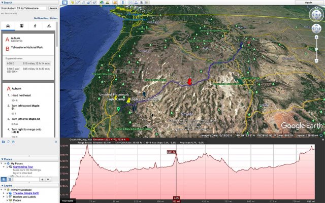
So I am looking for a website or app (free preferably) that I can punch in my projected trip and it shows the elevation changes along that route. I am having no luck. Has anyone used a site or app that does this? We are taking our first big trip west this summer (late june) with our 26' TT. We are headed from louisville, KY to mt. rushmore to yellowstone/tetons to rocky mtn np then colorado springs and back home to KY. I want to know what to expect along the route.
Can anyone help me out? I am new to the site, but have been impressed with how nice and helpful everyone is on here.
Can anyone help me out? I am new to the site, but have been impressed with how nice and helpful everyone is on here.