CharlesinGA
Well-known member
I originally posted this as a running log on the Winnebago View/Navion Forum on Yahoo. Thought it would be of interest here so I have lifted the posts and placed them here. I will attempt to edit them somewhat for clarity and to add a few pics too, when I get a chance in the next few days.
Edit, corrected spelling, punctuation, and added links for many items mentioned.
Charles
Day One, Launched out this morning about 8 am eastern time. Drove 498 miles wiith a fuel stop near the house and one just north of Nashville. Had breakfast at Cartersville GA and a early dinner/late lunch at Paducah KY Chick-Fil-A. Arrived at Crab Orchard Lake National Wildlife Refuge Campground about 5:30 pm central time.
Found that the fan does a continuous cycling and engine tends to run much hotter when I have it on 70mph (68 according to the GPS) and when I drop back an actual 65 mph, the engine runs much cooler, and if I drop back to 62 actual mph, it does best of all, fan rarely runs except for long uphill grades. Refilled at exactly 300 miles and was under 16 mpg, about the worst I have ever had. Slowed down after the fillup, so next tank full will be better mileage. Gauge is inop so I fill it at 300 miles and it takes between 16 and 18 gallons generally, took almost 19 gallons this time. I have a spreadsheet I will enter all of this in when I get home.
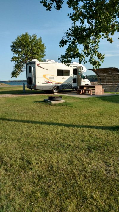
Crab Orchard lake is real nice, and lots of great campsites. I don't think there is a bad one in the bunch. They were nearly full, I got the next to the last site.
https://goo.gl/maps/JxJD9ArFry22
This is just off Illinois highway 13 between Carbondale and Marion. Easy stop and not out of the way. tomorrow I will cross the Mississippi at Chester ILL (home of the creator of Popeye) and head north and skirt around west side of St. Louis and head to KC, will stay outside of it on the outer loop I-435 and head north on I-29. Hope to make Horseshoe Casino at Council Bluffs IA tomorrow evening. Google Maps says 544 miles., nearly all interstate.
Thinking I will stay in Spearfish at the city campground and just rent a car. Black Hills is best seen from a car or motorcycle and is small enough to make several day trips in a car to see everything.. Will migrate down toward Hot Springs late in the week.
Day Two, Well, sitting here after midnight waiting on the clothes dryer. At Horseshoe Casino tonight. Pricey but secure and easy to get to. Gorged on the also pricey buffet. Headed for the Badlands tomorrow.
Had a good ride, esp the last two hours coming up the Missouri River valley on I 29. Doing about 63 actual mph per the GPS. Never touched the cruise control. Temp stable about 200 and smooth. Cities are horrible. Rough bumpy potholes irregular pavement. Atlanta Chattanooga Nashville St Louis.. hit one hole on I64 St Louis thought I had damaged something. Everything looks ok.
Day Three, Well, my intended destination tonite was the Badlands but I saw that I would be late and called Cedar Pass Campground and was told it was first come first serve on remaining sites. Was afraid I would arrive with no spaces left, so............
Detoured at Chamberlain to a COE campground below Big Bend dam on the Missouri River. Below lake Sidney. Absolutely perfect. Electric, scattered spigots, and a dump station. $18 and cost me $9.
Lawn grass with no bare patches and concrete picnic tables on slabs and fine crush gravel parking pads.
Beautiful scenery on the ride in, but lots of steep grades. Partly thru the Crow Reservation.
Very secure location with dam above and completely surrounded on three sides with water. Just below the left powerhouse.
https://goo.gl/maps/6h67oEmkzwk
https://www.recreation.gov/camping/left-tailrace-campground/r/campgroundDetails.do?contractCode=NRSO&parkId=150041
I never bothered to explain why I didn't make the miles on Day Three, I had stopped at Mitchell to see the Corn Palace (there are other things to see, but I simply didn't have the time) The Corn Palace is a unique place in that the exterior of the building is covered with corn cobs split in half lengthwise. Different color corn is used and murals and scenes are created with it. It is all replaced once a year at a cost of $130K. This put me two hours or so behind. I had previously researched the COE campground online and thought it would make a good alternate stop if needed, which it was.
http://www.cornpalace.org/
Day Four, Well, SD highway 47 from the Left Tailrace COE campground at Fort Thompson, back to I-90 at Reliance SD is a much better drive than the way I went in from Chamberlain. Made it to the Badlands and drove thru that, without a pass it is expensive, $20 per car. My new senior pass gets you in free, but even the $80 pass will and use it a couple of other places and it has paid for itself also.
Stopped briefly in Wall, real neat tourist trap, and moved on as I had a rental car reservation at 3:30 PM. I stopped for fuel and made it to the Spearfish campground and checked in, parked in my site and then hoofed it the few blocks to Enter$urprise Rental Car. Walked in the door at exactly 3:30.
If someone opens an Ugly Duckling or Rent a Wreck in Spearfish, or even one of the other big names, Enterprise is done for.
I have to turn the car in Friday afternoon so I think tomorrow will be a trip down to Rushmore and Crazy Horse carvings and all the driving I can do in that area.
This is a very nice campground and is right in town. It is packed tight, typical of many campgrounds, but well done and they had limited space to set this up as it is in a canyon. Federal Fish Hatchery is right next door, along with the city park.
The Spearfish campground is a great place to stay. Indeed it has its share of quirks. All of the full hookup sites have the power, water, and sewer directly behind the site, paired with the site that backs up to you. In my case, the sewer is somewhat high compared to the pad, so if I had a hose long enough, the you know what would have to flow uphill, and and we all know that won't happen. The dump station is directly in front of me, across the 12 ft wide "road" on its own little "loop" and so on Friday evening in preparation for leaving Saturday, I will move long enough to dump the tanks.
The other odd quirk is the toilets in the restrooms. The stall doors barely, by only an inch or less, clear the front of the bowls, so to get in and shut the door, you have to turn sideways and slide between the side of the stall and the bowl. Who was thinking of this? What I have discovered is that city campgrounds tend to be designed and setup by someone who knows nothing about RV's and camping, and everything is a guess. The sites are kinda close, but not really bad at all. They each have a numbered picnic table and a fire ring,along with all the nice hookups. My site is square to the road, with trees tight on either side of the pad at the road, so it takes a little patience to back in and clear everything.
All of that being said, the showers are among the nicest I have seen, and everything is quite clean, and the parks department shops being only a block or two down the street means that are responsive to any problems that arise. In addition the police department is the next block past the parks shop and there the worlds nicest, cleanest, best kept 24/7 laundry mat right past the police department.
The main city park is adjacent to the campground, in fact the overflow parking for the campground is the park's parking lot. The park is super nice and there is another park about two blocks away. The Federal Fish Hatchery is also located right next to the campground and people can be seen at all hours wandering about looking at the fish ponds. The place looks like a fancy garden with pools, bridges and signs explaining what is happening in each pond.
Spearfish creek which runs for a number of miles thru the Spearfish canyon (and has a Scenic byway road you can drive thru the canyon), runs thru the park, campground and fish hatchery before winding its way across town and apparently disappearing in a sink hole. Its all crystal clear water flowing over the rocks, a rather icyllic and peaceful setting.
https://www.cityofspearfish.com/departments/city_campground/index.php
Day Five, Today I drove the rental car about 200 miles. Left Spearfish and drove down the interstate a couple of exits to US 85 and headed south to Deadwood. Man, what a crazy place that is, 100% tourist trap and gambling. Took 385 from there down to 16 to Keystone and 244 to Rushmore. You gotta pay the concession that operates the place for parking, but no other fees. Lady at the toll booth asked if I was a senior and I said yes, and paid $5 for parking, its usually $10. You get a pass that is good for a year. Watched most of a movie, and looked at the displays and such, all real nice, made a selfie with the carving in the background, and left. I noticed a lot of people who had parked around me had either left or were leaving, so I guess everyone can stand only so much. left and went on down 244 west and down 385/16 to Crazy Horse and found most everyone who was at Rushmore was there. Watched another movie and spent much more time there than at Rushmore. It actually was more interesting, and they have a lot of excellent items and artifacts on display.
If you go to Rushmore in your Class C, and it is under 28 ft, there is lots of angled parking just for these shorter RV's, its easy in and out. Longer rigs and travel trailers along with buses go to the top of the parking deck, which is actually fairly easy in and out also.
Leaving Crazy Horse, I went to the Stockade Lake entrance to Custer State Park and paid my $20 (ouch!) and drove the entire wildlife loop (saw very little, probably wrong time of day) and then took the Iron Mountain Highway back to Keystone. The high point on the Highway is about 5600 ft or very close to it according to my GPS and downtown Keystone was about 4400 ft.
Remember, I was doing all of this in a Hyundai Santa Fe and not my View.
I saw one Navion headed opposite me on the Wildlife Loop and just at the end of it for me, I saw a Class A, something like a Georgetown headed past. He was in for some fairly tight turns.
Whatever you do, grab a paper map of the Blackhills, there is one put out by the Black Hills/Badlands Tourist Association and are found almost everywhere. I started out with Google Maps only to have google shut it down this morning for some kind of update, not for my app, but for their mainframes. Lucky, the signage in the Blackhills is nearly perfect and very through.
https://www.blackhillsvacations.com/plan-your-visit/black-hills-maps
http://www.blackhillsbadlands.com/maps
Not sure about tomorrow, probably will drive the Spearfish Canyon highway 14A and then hook back up to Deadwood (might even stop for a few minutes) and I might just go down to Hill City for the train ride, then do the Needles Highway.
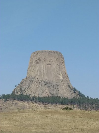
I turn the car in Friday afternoon and check out of Spearfish Saturday morning. Will probably do Devils Tower Saturday, then find my way to the Hotsprings area for the night. Might go to Cold Brook COE campground and see if any of the dozen or so sites are open (no hookups).
Day Six, Well drove down into the Black Hills again today. First I drove the Scenic byway thru Spearfish Canyon. If you are in the area, I highly recommend doing this, it is by far the most scenic drive imaginable. This took me back up to Deadwood and then I went down 385 toward Hill City. I stopped at the Roubiax US Forest Service campground to see it there would be open spots and the host said that by Saturday morning all of the walkups would be full. I then drove to Hill city and caught the 1:15 train to Keystone, which is a 10 mile, one hour ride, and then returned to Hill city. The locomotive is a huge 222,000 lb Baldwin Steam 2-6-2 and it struggles with seven cars behind it leaving Hill City. They say it is a 200 ft rise in just a couple of miles and then it is all down hill to Keystone, a 4 to 6 percent grade, supposedly one of the steepest grades on a rail line in the nation.
https://www.1880train.com/
After leaving Hill City, I drove down to the Needles Highway and drove the length of it, much of it in the rain. Also drove most of the way back to Spearfish in the rain, with it only drying up about Deadwood.
Tomorrow I have to turn in the car by 3:30 so I think I will run out to Devils Tower, about an hour+ away from Spearfish, and check it out.
Day Seven, Well, Friday, I had to turn in the rental car at 3:30pm so I made a short day of it. I ran over to Devils Tower, going over got off at the Wyoming welcome center at exit 199 and checked it, one of the nicest I have seen with really good displays. Not just a bunch of brochures. Instead of getting back on the interstate, I went north on state rt 111 about 8 miles to where it tee'ed into state route 24 and went west thru the Black Hills Nat Forest, and Hulett and down to Devils Tower. Lots of people there, a bus load of European tourists.... There is a walking trail that goes up to the edge of the boulder field and then all the way around, about a mile and a half or so. The trail is asphalt about 3 ft wide and has lots of wide spots and benches to sit at. you also get a good view of the valley and the Belle Fourche River. The walk is not particularly strenuous however the altitude, about 4400 ft or so, will make it more difficult. I saw one fellow who was having to sit down at almost every bench he came to. You can climb on the boulders, just not above them, without a permit. There were several people making ascents of the tower while I was there.
When I got there, I saw a particularly nice looking '07 View H there, very clean and shiny and probably stored indoors its entire life. After the walk around the tower I went to it and saw the door open so I introduced myself and found that they had bought it from a dealer and it had come from the original owners estate, with 34K miles on it. I chatted a minute and noted that it had a nice new electric Dometic awning, which they said they had not used (this was only their third or fourth trip and first long one) and it also had window awnings, which I liked very much..
The return trip I went south on 24 and US 14 and got back on the interstate at Sundance. I did get off at the welcome station exit again but to go and visit the Vore Buffalo Jump site. Very interesting how the Indians managed to stampede buffalo herds and get some to fall into this sinkhole where they could kill them and process them. The layering in the bottom of the sink hole tells a story of how often it was done and what was done.
https://www.vorebuffalojump.org/content/
Finished off friday evening at Spearfish campground doing nothing. Then things started to go astray. I went to use their nice showers late, about 10 pm only to discover they had decided to reprogram the electronic locks on the showers and restrooms and put a note on the door to see the office for the combination, fine time for me to find out. Moved to the dump station in this (saturday) morning and emptied the tanks, had previously filled the water tank and was using their water via hose for the stay. Did more laundry, sheets and towels and stuff I had missed the day before. Then I headed to the Walmart, and the fun begins. I get to the corner to turn to the Walmart, right at the interstate exit, and they have lots of construction going on. I can see the wall mart, practically throw a rock and hit it, but about 500 ft of the road was restricted to 7 ft or less width, so the only way to get there was a 3 mile ride on gravel roads around a hill and come in from the other side.
I'll tell the remainder of this sorid story later............................
Day Eight, Lets see, on Saturday morning I was headed to Walmart and discovered that because I was over 20 ft and over 7 ft wide, I had to take a 3 mile gravel detour route (properly marked as such). When I cam out from Walmart I started the generator and A/C while I put away the items I had bought. Then I decided to fix a sandwich and while eating it there was a fly buzzing around inside. It was at that point I remembered that I had intended to buy some fly strips, as the flies at Chamberlin were terrible on the trip out. I went in the store and found and bought the strips, and when I got back to the View, I, without thinking proceded to pull out one of them. If you have ever dealt with fly strips, the goo they use in them is excellent for getting on anything it touches, and it was then that I realized I had no easy way to hang the strip. Before it was over I had goo on the floor, the cabinets, and myself, but finally managed to get a ty-wrap from the tool bag and hung it from the A/C Chill Grille. I then attempted to remove the goo with rubbing alcohol but it had no effect on the goo, so back in the store for the third time to get some Ronson lighter fluid (naptha) which finally did the job.
I was finally able to leave for Rapid City and made the circuitous route around the hill on the gravel road to get on I-90 eastbound. I got to Rapid City and went to a museum called the Journey, which I found very interesting, and highly recommend it. It was during my time in the Journey that my brother began giving me his ETA for Rapid City, except he did not account for the time zone change to his advantage. He arrived and came straight to the museum, and then we went downtown to the Alex Johnson Hotel, an old 1920?s restored hotel operated by Hilton. (I parked two blocks away in the School System administration parking lot, which is open parking on weekends). We ate nearby at the Firehouse Brewing Company and I headed for Hot Springs. Previously I had called the Hot Springs KOA and left a message, and while I was parking the View down the street from the hotel, they returned my call. There was a cancelation and could accommodate me for Saturday nite, so I hustled on down there and arrived at 8:45 PM. I must say, this KOA has their act together, as it is new, younger owners who are working to make this one the best KOA in the country, I was treated well and they had decent showers and restrooms. Many of the sites needed regarding to properly level them, but it takes time to do things.
http://www.journeymuseum.org/visit
https://www.firehousebrewing.com/
http://curiocollection3.hilton.com/en/hotels/south-dakota/hotel-alex-johnson-rapid-city-curio-collection-by-hilton-RAPSSQQ/index.html
https://koa.com/campgrounds/hot-springs/
Day Nine, Sunday I first went to the Mammoth Site in Hot Springs (very highly recommended) and then drove up to Cold Brook COE Reservoir to see what the campsites looked like. After that, I went to the local DQ and had some chicken fingers. There were RV?s everywhere, probably for the eclipse. After leaving the DQ I drove some 50+ miles to Chadron, Nebraska (79 is a great 4 lane highway from Rapid City to the Nebraska line, but two lane in NE). In Chadron I fueled up and went to the Museum of the Fur Trade. This is a well done museum that has been around since the mid ?50?s and is built on the site of a 1700?s fur trading post. The exhibits are vast and well displayed and the NRA noted in an article on trade guns in 2011 or 2012 that this museum had the most extensive collection of trade guns in the world. These were generally simple, well made guns to be traded by the big English and French trading companies to the Indians and the fur traders for the furs they collected.
www.furtrade.org/
http://mammothsite.com/
After leaving the museum I headed south on US 385 toward Alliance NE to look for a place to park for the night and view the eclipse on Monday.
My brother and his wife were in Rapid City (simply known as "Rapid" to the locals) on Sunday, waiting for their 23 year old daughter (my neice) to arrive by air from Fargo. (He is retired airline, I am still full time, so she was riding a pass), and while they were in Rapid City, I was touring and traveling to Alliance.
I did drive to Hemmingford, as they have a bunch of RV parking with power pedestals and water at the fair grounds, and indeed there were a few RV's there. Previously I had attempted to contact the fair grounds managment, by both email and telephone messages, and over a period of several months, never heard back from them. Apparently they only communicate by facebook, which I do not do. I could have probably pulled in and hooked up and no one would have shown up for my place, but my brother wanted to be closer to Alliance, preferably Carhinge.
So I drove on over, and down to Carhinge, all the while having RV's passing me northbound, away from Alliance. When I got there, there were way too many people, cars and RV's to my liking, and I was seeing signs with prices like $100 RV parking, etc., so I turned and headed back North, This is where it gets interesting. The cross roads are exactly 1 mile apart, and when I got 2 miles from the Carhinge parking, I saw a couple of RV's and a home made sign, so I turned off, and got out to ask about the deal. I ended up paying $50 and got to park with two (newer) Navions, and another (newer also) View, along with a guy in a very nice Chevy pop top conversion van camper. All from Minnesota.
Turns out these guys had been staying at Chadron State Park and had driven down and like me, turned around and headed away but saw this place (some kind of district or private school, not sure, with a family living in it and apparently operating a school out of it) (no sign up at the time) and pulled in and offered him $50 each to park. He had not intended to open to parking but, saw a quick buck and allowed them to park on the basketball court. The ground was solid and mowed, so I pulled in and parked in the grass and we all had a great conversation for the evening.
Day Ten, The next morning was foggy, but it burned off clear, and later, before the eclipse, scattered clouds began to blow thru. With my GPS coordinates, my brother found us and we all sat around and watched the eclipse unfold. Very surreal to watch the shadow approach from the west like dark storm clouds, with a red glow above them, and then it went dark. I had ordered several sets of the eclipse sun glasses, so we were all set. My brother gave me a sheet of the USPS eclipse stamps, which are heat sensitive. They are black and you hold your finger on them and the suns corona shows up.
I considered taking highway 385 south out of Alliance to Bridgeport and then 26 east to Interstate 80 at Ogallala, but I knew there would be a lot of traffic and decided to take Nebraska highway 2 east out of Alliance (I found out later in the afternoon from another camper at Nebraska Nat Forest that this was a very good decision on my part). This was about 1 in the afternoon. Highway 2 is not a bad ride and most of the towns are off to the side and do not require that you slow down.
Something told me to get off the road early, so when I arrived at the Bessey Recreation Complex of the Nebraska National Forest at Halsey, NE, I decided to get off. You turn off over a busy double train track, cross the rather large and fast flowing Middle Loupe River, and then pull into the self registration booth area of the campground, Its less than a half mile off the highway. I drove one of the three loops, full, and as I was preparing to drive another loop I spotted a post, #2 Vacant, it says. An odd spot, not on the loop, but by itself across from some of the picnic car parking. Lots of slope, but I backed in and put blocks under the front wheels and pulled onto them, still not enough, but would do for the night. Got out, plugged in and walked the 100 yards or so to the registration booth. By then people were flowing in, and while there was a host rig parked there (he was inside) he made no attempt to help anyone. I pointed out the loop I had driven with no luck and the other two loops they could drive, to several others. One guy (Viet nam vet) found a nice paved pull thru with no electric for his Surburban and quite small travel trailer, others, including a '06 View from Canada, drove thru and left. It seemed I had found the last power spot and the Viet Nam vet with the Surburban found the last non power site (I thought)...... I walked his loop, mostly tents, and got to the end, and found a real nice site, grass and flat, table and fire ring, OUTSIDE the gate to the loop and apparently overlooked by all, an added site with odd numbering. Back at the registration a couple of guys in a car, tent camping, came in and I told them to hustle around the loop and get that space, which they did. This Nebraska National Forest is HAND PLANTED, starting in the 1930's. Trees planted on the sand hills, from seedlings raised in a seedling farm right there.
[urlhttps://goo.gl/maps/socFdKq64fF2][/url]
https://www.recreation.gov/camping/bessey-recreation-complex/r/campgroundDetails.do?contractCode=NRSO&parkId=74135
Great showers by the way, best I have encountered, cost $5.50 for the nite for a senior discount power site. That $10 card has saved me ($20 at Devils Tower, $20 Badlands, $5 at Rushmore parking, $9 at Left Tailrace Campground, $5.50 at Bessey Nat Forest, $10 at Crab Orchard Nat Wildlife Refuge Campground, and one or two other places).
Days Eleven and Twelve, Up early on Tuesday, I was out about 7:45 and headed to Grand Island, then I-80 east to Lincoln where I got off and picked up NE 2 again to Nebraska City. The last ten miles was nice looking concrete but the uphill runs were washboard, and never ground smooth and coincided with my wheelbase to create crowhopping, horrible ride. Headed down I-29 toward Kansas City and got caught up in the afternoon traffic, but wasn't too bad. At a fuel stop I had called Graham Cave State Park, Danville, Missouri, about 70 west of St Louis and the Ranger said there would be lots of open spots and told me how to find it and do late registration upon arrival.
https://mostateparks.com/park/graham-cave-state-park
I drove 600 miles that day, and arrived at Graham Cave just after dark. Set up, registered, $19 for a power site, and took a shower (pretty clean showers and restrooms). Got up Wednesday morning and waited for the inbound St Louis traffic to die off, and headed out. I-70 to I-64 to I-270 to I-55 south, to Cape Girardeau, MO, and crossed Illinois in a winding fashion as some roads were closed and I had to take other routes, Stopped at Metropolis, IL long enough to take a picture of Superman, and a quick visit to Ft. Massac State Park, but decided not to camp, and headed south on I-24, after rest stops and fuel stops, and food stops, I arrived home at 3:30 in the morning to two very anxious cats, having been gone 12 days.
Charles
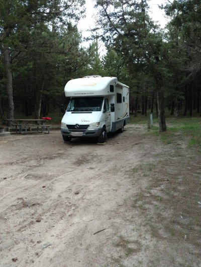
2007 Winnebago View 523H on a 2006 Dodge (Daimler-Chrysler aka Mercedes) Sprinter 3500 chassis (T1N). Bought Sept 2015 with 18K miles on it, Prog Ind HW30C, Prog Dymanics PD4645, Coleman Chill Grille, PML/Yourcovers.com deep alum trans pan, AutoMeter 8558 trans temp gauge, Roadmaster sway bar, Koni Red shocks (front & rear), Fantastic Ultra Breeze hood, added OEM parabolic mirrors and RH aspherical mirror, MB grill conversion.
Edit, corrected spelling, punctuation, and added links for many items mentioned.
Charles
Day One, Launched out this morning about 8 am eastern time. Drove 498 miles wiith a fuel stop near the house and one just north of Nashville. Had breakfast at Cartersville GA and a early dinner/late lunch at Paducah KY Chick-Fil-A. Arrived at Crab Orchard Lake National Wildlife Refuge Campground about 5:30 pm central time.
Found that the fan does a continuous cycling and engine tends to run much hotter when I have it on 70mph (68 according to the GPS) and when I drop back an actual 65 mph, the engine runs much cooler, and if I drop back to 62 actual mph, it does best of all, fan rarely runs except for long uphill grades. Refilled at exactly 300 miles and was under 16 mpg, about the worst I have ever had. Slowed down after the fillup, so next tank full will be better mileage. Gauge is inop so I fill it at 300 miles and it takes between 16 and 18 gallons generally, took almost 19 gallons this time. I have a spreadsheet I will enter all of this in when I get home.
Crab Orchard lake is real nice, and lots of great campsites. I don't think there is a bad one in the bunch. They were nearly full, I got the next to the last site.
https://goo.gl/maps/JxJD9ArFry22
This is just off Illinois highway 13 between Carbondale and Marion. Easy stop and not out of the way. tomorrow I will cross the Mississippi at Chester ILL (home of the creator of Popeye) and head north and skirt around west side of St. Louis and head to KC, will stay outside of it on the outer loop I-435 and head north on I-29. Hope to make Horseshoe Casino at Council Bluffs IA tomorrow evening. Google Maps says 544 miles., nearly all interstate.
Thinking I will stay in Spearfish at the city campground and just rent a car. Black Hills is best seen from a car or motorcycle and is small enough to make several day trips in a car to see everything.. Will migrate down toward Hot Springs late in the week.
Day Two, Well, sitting here after midnight waiting on the clothes dryer. At Horseshoe Casino tonight. Pricey but secure and easy to get to. Gorged on the also pricey buffet. Headed for the Badlands tomorrow.
Had a good ride, esp the last two hours coming up the Missouri River valley on I 29. Doing about 63 actual mph per the GPS. Never touched the cruise control. Temp stable about 200 and smooth. Cities are horrible. Rough bumpy potholes irregular pavement. Atlanta Chattanooga Nashville St Louis.. hit one hole on I64 St Louis thought I had damaged something. Everything looks ok.
Day Three, Well, my intended destination tonite was the Badlands but I saw that I would be late and called Cedar Pass Campground and was told it was first come first serve on remaining sites. Was afraid I would arrive with no spaces left, so............
Detoured at Chamberlain to a COE campground below Big Bend dam on the Missouri River. Below lake Sidney. Absolutely perfect. Electric, scattered spigots, and a dump station. $18 and cost me $9.
Lawn grass with no bare patches and concrete picnic tables on slabs and fine crush gravel parking pads.
Beautiful scenery on the ride in, but lots of steep grades. Partly thru the Crow Reservation.
Very secure location with dam above and completely surrounded on three sides with water. Just below the left powerhouse.
https://goo.gl/maps/6h67oEmkzwk
https://www.recreation.gov/camping/left-tailrace-campground/r/campgroundDetails.do?contractCode=NRSO&parkId=150041
I never bothered to explain why I didn't make the miles on Day Three, I had stopped at Mitchell to see the Corn Palace (there are other things to see, but I simply didn't have the time) The Corn Palace is a unique place in that the exterior of the building is covered with corn cobs split in half lengthwise. Different color corn is used and murals and scenes are created with it. It is all replaced once a year at a cost of $130K. This put me two hours or so behind. I had previously researched the COE campground online and thought it would make a good alternate stop if needed, which it was.
http://www.cornpalace.org/
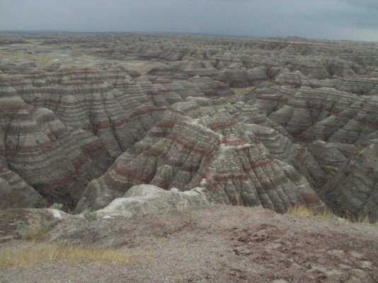
Day Four, Well, SD highway 47 from the Left Tailrace COE campground at Fort Thompson, back to I-90 at Reliance SD is a much better drive than the way I went in from Chamberlain. Made it to the Badlands and drove thru that, without a pass it is expensive, $20 per car. My new senior pass gets you in free, but even the $80 pass will and use it a couple of other places and it has paid for itself also.
Stopped briefly in Wall, real neat tourist trap, and moved on as I had a rental car reservation at 3:30 PM. I stopped for fuel and made it to the Spearfish campground and checked in, parked in my site and then hoofed it the few blocks to Enter$urprise Rental Car. Walked in the door at exactly 3:30.
If someone opens an Ugly Duckling or Rent a Wreck in Spearfish, or even one of the other big names, Enterprise is done for.
I have to turn the car in Friday afternoon so I think tomorrow will be a trip down to Rushmore and Crazy Horse carvings and all the driving I can do in that area.
This is a very nice campground and is right in town. It is packed tight, typical of many campgrounds, but well done and they had limited space to set this up as it is in a canyon. Federal Fish Hatchery is right next door, along with the city park.
The Spearfish campground is a great place to stay. Indeed it has its share of quirks. All of the full hookup sites have the power, water, and sewer directly behind the site, paired with the site that backs up to you. In my case, the sewer is somewhat high compared to the pad, so if I had a hose long enough, the you know what would have to flow uphill, and and we all know that won't happen. The dump station is directly in front of me, across the 12 ft wide "road" on its own little "loop" and so on Friday evening in preparation for leaving Saturday, I will move long enough to dump the tanks.
The other odd quirk is the toilets in the restrooms. The stall doors barely, by only an inch or less, clear the front of the bowls, so to get in and shut the door, you have to turn sideways and slide between the side of the stall and the bowl. Who was thinking of this? What I have discovered is that city campgrounds tend to be designed and setup by someone who knows nothing about RV's and camping, and everything is a guess. The sites are kinda close, but not really bad at all. They each have a numbered picnic table and a fire ring,along with all the nice hookups. My site is square to the road, with trees tight on either side of the pad at the road, so it takes a little patience to back in and clear everything.
All of that being said, the showers are among the nicest I have seen, and everything is quite clean, and the parks department shops being only a block or two down the street means that are responsive to any problems that arise. In addition the police department is the next block past the parks shop and there the worlds nicest, cleanest, best kept 24/7 laundry mat right past the police department.
The main city park is adjacent to the campground, in fact the overflow parking for the campground is the park's parking lot. The park is super nice and there is another park about two blocks away. The Federal Fish Hatchery is also located right next to the campground and people can be seen at all hours wandering about looking at the fish ponds. The place looks like a fancy garden with pools, bridges and signs explaining what is happening in each pond.
Spearfish creek which runs for a number of miles thru the Spearfish canyon (and has a Scenic byway road you can drive thru the canyon), runs thru the park, campground and fish hatchery before winding its way across town and apparently disappearing in a sink hole. Its all crystal clear water flowing over the rocks, a rather icyllic and peaceful setting.
https://www.cityofspearfish.com/departments/city_campground/index.php
Day Five, Today I drove the rental car about 200 miles. Left Spearfish and drove down the interstate a couple of exits to US 85 and headed south to Deadwood. Man, what a crazy place that is, 100% tourist trap and gambling. Took 385 from there down to 16 to Keystone and 244 to Rushmore. You gotta pay the concession that operates the place for parking, but no other fees. Lady at the toll booth asked if I was a senior and I said yes, and paid $5 for parking, its usually $10. You get a pass that is good for a year. Watched most of a movie, and looked at the displays and such, all real nice, made a selfie with the carving in the background, and left. I noticed a lot of people who had parked around me had either left or were leaving, so I guess everyone can stand only so much. left and went on down 244 west and down 385/16 to Crazy Horse and found most everyone who was at Rushmore was there. Watched another movie and spent much more time there than at Rushmore. It actually was more interesting, and they have a lot of excellent items and artifacts on display.
If you go to Rushmore in your Class C, and it is under 28 ft, there is lots of angled parking just for these shorter RV's, its easy in and out. Longer rigs and travel trailers along with buses go to the top of the parking deck, which is actually fairly easy in and out also.
Leaving Crazy Horse, I went to the Stockade Lake entrance to Custer State Park and paid my $20 (ouch!) and drove the entire wildlife loop (saw very little, probably wrong time of day) and then took the Iron Mountain Highway back to Keystone. The high point on the Highway is about 5600 ft or very close to it according to my GPS and downtown Keystone was about 4400 ft.
Remember, I was doing all of this in a Hyundai Santa Fe and not my View.
I saw one Navion headed opposite me on the Wildlife Loop and just at the end of it for me, I saw a Class A, something like a Georgetown headed past. He was in for some fairly tight turns.
Whatever you do, grab a paper map of the Blackhills, there is one put out by the Black Hills/Badlands Tourist Association and are found almost everywhere. I started out with Google Maps only to have google shut it down this morning for some kind of update, not for my app, but for their mainframes. Lucky, the signage in the Blackhills is nearly perfect and very through.
https://www.blackhillsvacations.com/plan-your-visit/black-hills-maps
http://www.blackhillsbadlands.com/maps
Not sure about tomorrow, probably will drive the Spearfish Canyon highway 14A and then hook back up to Deadwood (might even stop for a few minutes) and I might just go down to Hill City for the train ride, then do the Needles Highway.
I turn the car in Friday afternoon and check out of Spearfish Saturday morning. Will probably do Devils Tower Saturday, then find my way to the Hotsprings area for the night. Might go to Cold Brook COE campground and see if any of the dozen or so sites are open (no hookups).
Day Six, Well drove down into the Black Hills again today. First I drove the Scenic byway thru Spearfish Canyon. If you are in the area, I highly recommend doing this, it is by far the most scenic drive imaginable. This took me back up to Deadwood and then I went down 385 toward Hill City. I stopped at the Roubiax US Forest Service campground to see it there would be open spots and the host said that by Saturday morning all of the walkups would be full. I then drove to Hill city and caught the 1:15 train to Keystone, which is a 10 mile, one hour ride, and then returned to Hill city. The locomotive is a huge 222,000 lb Baldwin Steam 2-6-2 and it struggles with seven cars behind it leaving Hill City. They say it is a 200 ft rise in just a couple of miles and then it is all down hill to Keystone, a 4 to 6 percent grade, supposedly one of the steepest grades on a rail line in the nation.
https://www.1880train.com/
After leaving Hill City, I drove down to the Needles Highway and drove the length of it, much of it in the rain. Also drove most of the way back to Spearfish in the rain, with it only drying up about Deadwood.
Tomorrow I have to turn in the car by 3:30 so I think I will run out to Devils Tower, about an hour+ away from Spearfish, and check it out.
Day Seven, Well, Friday, I had to turn in the rental car at 3:30pm so I made a short day of it. I ran over to Devils Tower, going over got off at the Wyoming welcome center at exit 199 and checked it, one of the nicest I have seen with really good displays. Not just a bunch of brochures. Instead of getting back on the interstate, I went north on state rt 111 about 8 miles to where it tee'ed into state route 24 and went west thru the Black Hills Nat Forest, and Hulett and down to Devils Tower. Lots of people there, a bus load of European tourists.... There is a walking trail that goes up to the edge of the boulder field and then all the way around, about a mile and a half or so. The trail is asphalt about 3 ft wide and has lots of wide spots and benches to sit at. you also get a good view of the valley and the Belle Fourche River. The walk is not particularly strenuous however the altitude, about 4400 ft or so, will make it more difficult. I saw one fellow who was having to sit down at almost every bench he came to. You can climb on the boulders, just not above them, without a permit. There were several people making ascents of the tower while I was there.
When I got there, I saw a particularly nice looking '07 View H there, very clean and shiny and probably stored indoors its entire life. After the walk around the tower I went to it and saw the door open so I introduced myself and found that they had bought it from a dealer and it had come from the original owners estate, with 34K miles on it. I chatted a minute and noted that it had a nice new electric Dometic awning, which they said they had not used (this was only their third or fourth trip and first long one) and it also had window awnings, which I liked very much..
The return trip I went south on 24 and US 14 and got back on the interstate at Sundance. I did get off at the welcome station exit again but to go and visit the Vore Buffalo Jump site. Very interesting how the Indians managed to stampede buffalo herds and get some to fall into this sinkhole where they could kill them and process them. The layering in the bottom of the sink hole tells a story of how often it was done and what was done.
https://www.vorebuffalojump.org/content/
Finished off friday evening at Spearfish campground doing nothing. Then things started to go astray. I went to use their nice showers late, about 10 pm only to discover they had decided to reprogram the electronic locks on the showers and restrooms and put a note on the door to see the office for the combination, fine time for me to find out. Moved to the dump station in this (saturday) morning and emptied the tanks, had previously filled the water tank and was using their water via hose for the stay. Did more laundry, sheets and towels and stuff I had missed the day before. Then I headed to the Walmart, and the fun begins. I get to the corner to turn to the Walmart, right at the interstate exit, and they have lots of construction going on. I can see the wall mart, practically throw a rock and hit it, but about 500 ft of the road was restricted to 7 ft or less width, so the only way to get there was a 3 mile ride on gravel roads around a hill and come in from the other side.
I'll tell the remainder of this sorid story later............................
Day Eight, Lets see, on Saturday morning I was headed to Walmart and discovered that because I was over 20 ft and over 7 ft wide, I had to take a 3 mile gravel detour route (properly marked as such). When I cam out from Walmart I started the generator and A/C while I put away the items I had bought. Then I decided to fix a sandwich and while eating it there was a fly buzzing around inside. It was at that point I remembered that I had intended to buy some fly strips, as the flies at Chamberlin were terrible on the trip out. I went in the store and found and bought the strips, and when I got back to the View, I, without thinking proceded to pull out one of them. If you have ever dealt with fly strips, the goo they use in them is excellent for getting on anything it touches, and it was then that I realized I had no easy way to hang the strip. Before it was over I had goo on the floor, the cabinets, and myself, but finally managed to get a ty-wrap from the tool bag and hung it from the A/C Chill Grille. I then attempted to remove the goo with rubbing alcohol but it had no effect on the goo, so back in the store for the third time to get some Ronson lighter fluid (naptha) which finally did the job.
I was finally able to leave for Rapid City and made the circuitous route around the hill on the gravel road to get on I-90 eastbound. I got to Rapid City and went to a museum called the Journey, which I found very interesting, and highly recommend it. It was during my time in the Journey that my brother began giving me his ETA for Rapid City, except he did not account for the time zone change to his advantage. He arrived and came straight to the museum, and then we went downtown to the Alex Johnson Hotel, an old 1920?s restored hotel operated by Hilton. (I parked two blocks away in the School System administration parking lot, which is open parking on weekends). We ate nearby at the Firehouse Brewing Company and I headed for Hot Springs. Previously I had called the Hot Springs KOA and left a message, and while I was parking the View down the street from the hotel, they returned my call. There was a cancelation and could accommodate me for Saturday nite, so I hustled on down there and arrived at 8:45 PM. I must say, this KOA has their act together, as it is new, younger owners who are working to make this one the best KOA in the country, I was treated well and they had decent showers and restrooms. Many of the sites needed regarding to properly level them, but it takes time to do things.
http://www.journeymuseum.org/visit
https://www.firehousebrewing.com/
http://curiocollection3.hilton.com/en/hotels/south-dakota/hotel-alex-johnson-rapid-city-curio-collection-by-hilton-RAPSSQQ/index.html
https://koa.com/campgrounds/hot-springs/
Day Nine, Sunday I first went to the Mammoth Site in Hot Springs (very highly recommended) and then drove up to Cold Brook COE Reservoir to see what the campsites looked like. After that, I went to the local DQ and had some chicken fingers. There were RV?s everywhere, probably for the eclipse. After leaving the DQ I drove some 50+ miles to Chadron, Nebraska (79 is a great 4 lane highway from Rapid City to the Nebraska line, but two lane in NE). In Chadron I fueled up and went to the Museum of the Fur Trade. This is a well done museum that has been around since the mid ?50?s and is built on the site of a 1700?s fur trading post. The exhibits are vast and well displayed and the NRA noted in an article on trade guns in 2011 or 2012 that this museum had the most extensive collection of trade guns in the world. These were generally simple, well made guns to be traded by the big English and French trading companies to the Indians and the fur traders for the furs they collected.
www.furtrade.org/
http://mammothsite.com/
After leaving the museum I headed south on US 385 toward Alliance NE to look for a place to park for the night and view the eclipse on Monday.
My brother and his wife were in Rapid City (simply known as "Rapid" to the locals) on Sunday, waiting for their 23 year old daughter (my neice) to arrive by air from Fargo. (He is retired airline, I am still full time, so she was riding a pass), and while they were in Rapid City, I was touring and traveling to Alliance.
I did drive to Hemmingford, as they have a bunch of RV parking with power pedestals and water at the fair grounds, and indeed there were a few RV's there. Previously I had attempted to contact the fair grounds managment, by both email and telephone messages, and over a period of several months, never heard back from them. Apparently they only communicate by facebook, which I do not do. I could have probably pulled in and hooked up and no one would have shown up for my place, but my brother wanted to be closer to Alliance, preferably Carhinge.
So I drove on over, and down to Carhinge, all the while having RV's passing me northbound, away from Alliance. When I got there, there were way too many people, cars and RV's to my liking, and I was seeing signs with prices like $100 RV parking, etc., so I turned and headed back North, This is where it gets interesting. The cross roads are exactly 1 mile apart, and when I got 2 miles from the Carhinge parking, I saw a couple of RV's and a home made sign, so I turned off, and got out to ask about the deal. I ended up paying $50 and got to park with two (newer) Navions, and another (newer also) View, along with a guy in a very nice Chevy pop top conversion van camper. All from Minnesota.
Turns out these guys had been staying at Chadron State Park and had driven down and like me, turned around and headed away but saw this place (some kind of district or private school, not sure, with a family living in it and apparently operating a school out of it) (no sign up at the time) and pulled in and offered him $50 each to park. He had not intended to open to parking but, saw a quick buck and allowed them to park on the basketball court. The ground was solid and mowed, so I pulled in and parked in the grass and we all had a great conversation for the evening.
Day Ten, The next morning was foggy, but it burned off clear, and later, before the eclipse, scattered clouds began to blow thru. With my GPS coordinates, my brother found us and we all sat around and watched the eclipse unfold. Very surreal to watch the shadow approach from the west like dark storm clouds, with a red glow above them, and then it went dark. I had ordered several sets of the eclipse sun glasses, so we were all set. My brother gave me a sheet of the USPS eclipse stamps, which are heat sensitive. They are black and you hold your finger on them and the suns corona shows up.
I considered taking highway 385 south out of Alliance to Bridgeport and then 26 east to Interstate 80 at Ogallala, but I knew there would be a lot of traffic and decided to take Nebraska highway 2 east out of Alliance (I found out later in the afternoon from another camper at Nebraska Nat Forest that this was a very good decision on my part). This was about 1 in the afternoon. Highway 2 is not a bad ride and most of the towns are off to the side and do not require that you slow down.
Something told me to get off the road early, so when I arrived at the Bessey Recreation Complex of the Nebraska National Forest at Halsey, NE, I decided to get off. You turn off over a busy double train track, cross the rather large and fast flowing Middle Loupe River, and then pull into the self registration booth area of the campground, Its less than a half mile off the highway. I drove one of the three loops, full, and as I was preparing to drive another loop I spotted a post, #2 Vacant, it says. An odd spot, not on the loop, but by itself across from some of the picnic car parking. Lots of slope, but I backed in and put blocks under the front wheels and pulled onto them, still not enough, but would do for the night. Got out, plugged in and walked the 100 yards or so to the registration booth. By then people were flowing in, and while there was a host rig parked there (he was inside) he made no attempt to help anyone. I pointed out the loop I had driven with no luck and the other two loops they could drive, to several others. One guy (Viet nam vet) found a nice paved pull thru with no electric for his Surburban and quite small travel trailer, others, including a '06 View from Canada, drove thru and left. It seemed I had found the last power spot and the Viet Nam vet with the Surburban found the last non power site (I thought)...... I walked his loop, mostly tents, and got to the end, and found a real nice site, grass and flat, table and fire ring, OUTSIDE the gate to the loop and apparently overlooked by all, an added site with odd numbering. Back at the registration a couple of guys in a car, tent camping, came in and I told them to hustle around the loop and get that space, which they did. This Nebraska National Forest is HAND PLANTED, starting in the 1930's. Trees planted on the sand hills, from seedlings raised in a seedling farm right there.
[urlhttps://goo.gl/maps/socFdKq64fF2][/url]
https://www.recreation.gov/camping/bessey-recreation-complex/r/campgroundDetails.do?contractCode=NRSO&parkId=74135
Great showers by the way, best I have encountered, cost $5.50 for the nite for a senior discount power site. That $10 card has saved me ($20 at Devils Tower, $20 Badlands, $5 at Rushmore parking, $9 at Left Tailrace Campground, $5.50 at Bessey Nat Forest, $10 at Crab Orchard Nat Wildlife Refuge Campground, and one or two other places).
Days Eleven and Twelve, Up early on Tuesday, I was out about 7:45 and headed to Grand Island, then I-80 east to Lincoln where I got off and picked up NE 2 again to Nebraska City. The last ten miles was nice looking concrete but the uphill runs were washboard, and never ground smooth and coincided with my wheelbase to create crowhopping, horrible ride. Headed down I-29 toward Kansas City and got caught up in the afternoon traffic, but wasn't too bad. At a fuel stop I had called Graham Cave State Park, Danville, Missouri, about 70 west of St Louis and the Ranger said there would be lots of open spots and told me how to find it and do late registration upon arrival.
https://mostateparks.com/park/graham-cave-state-park
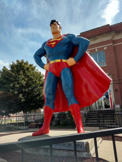
I drove 600 miles that day, and arrived at Graham Cave just after dark. Set up, registered, $19 for a power site, and took a shower (pretty clean showers and restrooms). Got up Wednesday morning and waited for the inbound St Louis traffic to die off, and headed out. I-70 to I-64 to I-270 to I-55 south, to Cape Girardeau, MO, and crossed Illinois in a winding fashion as some roads were closed and I had to take other routes, Stopped at Metropolis, IL long enough to take a picture of Superman, and a quick visit to Ft. Massac State Park, but decided not to camp, and headed south on I-24, after rest stops and fuel stops, and food stops, I arrived home at 3:30 in the morning to two very anxious cats, having been gone 12 days.
Charles
2007 Winnebago View 523H on a 2006 Dodge (Daimler-Chrysler aka Mercedes) Sprinter 3500 chassis (T1N). Bought Sept 2015 with 18K miles on it, Prog Ind HW30C, Prog Dymanics PD4645, Coleman Chill Grille, PML/Yourcovers.com deep alum trans pan, AutoMeter 8558 trans temp gauge, Roadmaster sway bar, Koni Red shocks (front & rear), Fantastic Ultra Breeze hood, added OEM parabolic mirrors and RH aspherical mirror, MB grill conversion.
")