Carson City NV to Stockton CA

The friendliest place on the web for anyone with an RV or an interest in RVing!
If you have answers, please help by responding to the unanswered posts.

therealsimpsons

Well-known member
Joined
Aug 23, 2009
Posts
1,405
Location
1 mile south of the Cheddar Curtain
We are planning a late summer trip to Yosemite, Kings Canyon, and Sequoia National Parks. We are taking I-80 west to I-580 down to Carson City, NV, and then to Stockton, Modesto, and Merced in CA. Our trip planner shows a CA route 88 to Stockton. It looks like there are some switchbacks along the way while going over the mountains. Is that route okay for our Beaver?
 
You'll be fine, beautiful country. Bring your trout gear, some great fishing as you cross over the pass. Do yourself a favor and stop at Lockford Meats in Lockford and stock up with sausage and other cuts. They have been there for years and earned a well deserved reputation on good meat and sausage,,,gregg
 
CA 88 is the Carson Pass Road.  The summit is at 8,573 feet and westbound it goes almost to sea level so it's a long descent.  How long is your motorhome and will you be towing?

I might suggest you get a copy of Mountain Directory West for Truckers, RV, and Motorhome Drivers.  CA 88 is on page 18.  It says that west of the summit has about 5 miles of 5-6 percent grade.  Then "Highway 88 is a roller coaster descent and would be too confusing to describe.  There is almost 20 miles of road between the 8,000' mark and the 7,000' mark, but there is only 12 miles of road between the 7,000' and 5,000' mark.  Some grades are in the 7% range for a couple of miles."

Based on the eastbound descent description it looks like your westbound ascent to the summit will be 8% for about 3 miles and about 9 miles of 3-8% (average 4-6%) for a total of 18 miles from the intersection of CA 88 and CA 89 at Markleeville near Alpine Village.

I would say it depends on how comfortable you are driving our western mountains.  California tries to keep this pass open during the winter which tells you it's one of the easier passes, but if you're a flatlander you might want to consider another route.

ArdraF
 
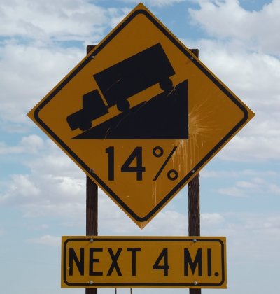
Thanks for the suggestions, Gregg and Ardra. We are 41 feet, towing. We've done this one..in Utah..route 12 from Capitol Reef National Park to Escalante, UT. 67 miles, no guardrails..lots of this:

Edit: Do you know if there are pull-offs along the way?
 

Attachments

  • 2012 Vacation 298 rsz.jpg
    2012 Vacation 298 rsz.jpg
    181.3 KB · Views: 9
Yes there's turnouts, wide areas, and a couple divided lanes in the up hill direction. RV's, Tractor/trailer's use it all the time. Trout streams open to fishing this weekend, we may head up  there sometime next week for few days. Beautiful country, a few bars and some restaurants that you can pull into, also Jackson Ranceria Casino has pretty good food and decent concerts are billed there.
 

Latest posts

Forum statistics

Threads
131,929
Posts
1,387,651
Members
137,677
Latest member
automedicmobile
Back
Top Bottom