Route suggestions: MS to NY?

The friendliest place on the web for anyone with an RV or an interest in RVing!
If you have answers, please help by responding to the unanswered posts.

jymbee

Well-known member
Joined
Feb 20, 2018
Posts
3,500
Location
Upstate NY
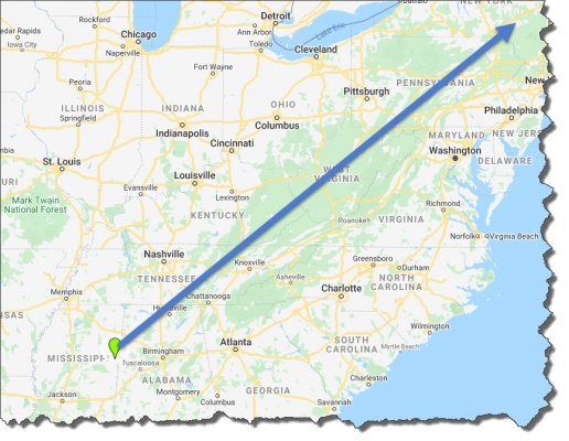
Our 12th reservation this current trip has us at the Lake Lowndes State Park in Columbus, MS. From there, no reservations or specific plans other than ending up at our home in Upstate NY in two or three weeks from then. The attached shows a A to B straight line, but most likely will pick spots South of that. Perhaps up through Atlanta, Richmond... ?

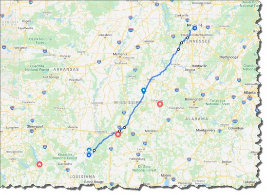
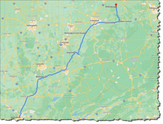
We like to schedule stops no more than 4 hours apart when convenient and stick pretty much exclusively to public parks as opposed to private. Would appreciate any thoughts as to possible places to visit along this route? Also, given the virus situation we tend to avoid the kinds of places we usually visit-- historical homes, museums, cool restaurants, etc. so nature & scenery are a higher priority this time out.
 

Attachments

  • route.jpg
    route.jpg
    211.6 KB · Views: 18
Well, through Atlanta, then toward Charlotte, then north to I81 and you are in NY.
Ok, now follow state routes instead and enjoy the scenery.
For me, I try to avoid getting too close to the coast as it encounters DC, Baltimore, Philadelphia & NYC.
 
Have you thought of the Natchez Trace to Nashville? Basic camp sites on the route (NO water, Electric etc). Full hookups and state parks near the route. Plenty of Pull offs for hiking, bird watching, Scenery viewing.
Then 31 E FROM NASHVILLE TO US 62 in BardsVille Kentucky. Meander up to Maysville Kentucky and cross into Ohio or better yet go to AUgusta Kentucky and take the ferry across the river into Ohio. Meander up US 62 to Washington Courthouse and then take US 22 to Zanesville. Pick up Ohio 83 through Amish country. In Millersburg get back on US 62  to Ohio 11 North to I 80 or I 90 East. I prefer 90 to Interstate 86 to Binghamton then in Binghamton to Interstate 84 towards Albany.
 
was just going to say, if time is not important i would not miss the Natchez Trace. Done at least some of it four times. great ride
 
darsben said:
Have you thought of the Natchez Trace to Nashville? Basic camp sites on the route (NO water, Electric etc). Full hookups and state parks near the route. Plenty of Pull offs for hiking, bird watching, Scenery viewing.
Then 31 E FROM NASHVILLE TO US 62 in BardsVille Kentucky. Meander up to Maysville Kentucky and cross into Ohio or better yet go to AUgusta Kentucky and take the ferry across the river into Ohio. Meander up US 62 to Washington Courthouse and then take US 22 to Zanesville. Pick up Ohio 83 through Amish country. In Millersburg get back on US 62  to Ohio 11 North to I 80 or I 90 East. I prefer 90 to Interstate 86 to Binghamton then in Binghamton to Interstate 84 towards Albany.

Thanks much for the detailed suggestions!

The Natchez Trace route looks like a definite possibility and actually could work quite well into our current itinerary and reservations. The one image attached shows that trail along with sites (in Red) where we currently have reservations.

The other image attached, if I understand your suggestions correctly, shows that potential route North out of Nashville.

We started out in Dec. working West across NY on Route 86 then 90 in Erie, PA on to Columbus, OH then SW to Texas. We live northeast of Binghamton so might retrace that route as we get close to home, or maybe wander a bit through PA. All depends on how anxious I am to get home by them.  :D


Attachments

  • trailmap_sm.jpg
    trailmap_sm.jpg
    250 KB · Views: 10
  • nashville_north_sm.jpg
    nashville_north_sm.jpg
    224 KB · Views: 9
The wife and  I came across and traveled 2/3 of the Trace on a return from Dallas, Thanksgiving Weekend.
Our first Big Trip  and start of many trips and, we will return to really drive the entire Trace.
As a detour We also stayed on the Mississippi for 2 nights,West Memphis Ar. Amazing
Great Country to wander around
Charlie Willett
 
Ditto on the Natchez Trace.  Lots of scenery and historical places along the way, including the place where Meriwether Lewis was shot and died.  And from Vicksburg to Nashville, it is 444 miles of a very pleasant drive with no stoplights!!

In fact, it is out of your way, but if it were me, I would cut down and start at Vicksburg, MS, but at least you can do the northern half.  Then maybe some day you can finish the southern part.  I have driven the entire Trace and enjoyed all the pullovers and historical stops along the way--very relaxing and non-stressful, but you can also get off easily if you need services. 

You are making me think that I would even like to drive it again. 
 
JudyJB said:
In fact, it is out of your way, but if it were me, I would cut down and start at Vicksburg, MS...

Once members here recommended the Natchez Trace Parkway I started looking at how that might mesh with the confirmed/paid (non-refundable) reservations we already had. As luck would have it, that route meshed perfectly. From the reservation in Anacoco, LA we can pick up the Trace Parkway in Natchez and continue on to the next reservation in Jackson, MS. From there on up the Trail to the next reservation around Columbus.  Continue North to end of the Trail from there.

From the descriptions posted here it sounds exactly like the kind of route we really enjoy. Like to avoid the Interstates & 4 lane roads when "wandering".  Need to keep fresh SD cards in the DashCam for sure.  :)
 
You won't regret it.  I took it about four years ago, and it was a two-lane roadway in very good condition with wide shoulders and scenic pullovers every few miles.  Do make sure you stop and view the original trace where it exists.  Some history--way back in the days before boats were powered, they used to take rafts (flatboats) down the Ohio River and unload them in Vicksburg.  But they obviously could not take the rafts back upstream, so they would walk or take a horse and wagon on the Trace and go back to Nashville.  And for hundreds of years before that, it was an Indian trail. 

Once steamboats and gasoline powered boats became available, the Trace was no longer used. 

All those feet and wheels dug the original Trace deep into the earth, so that in some places it is 10-15' deep.  And it is so old, huge trees have grown up in it in some places.  Very unique place and rich in history. 

Also, while you are in Vicksburg, make sure you visit the National Battlefield and the old steamboat along the river.  There is a bridge across the Mississippi at Vicksburg and you can drive and park underneath on both sides to view the river.  Nice to walk around the town, as well. 
 
Jimbee,

The Trace is a great run 444 miles of low speed limits (believe it) and zero cross traffic.  There really is an historical marker about every other mile.
As you will be starting from the south, buy the book at the first visitor center and read it as you go.  We have run the complete Trace twice and many other partials bits.  Have the map (that you picked up at the visitor center out to watch for where the actual trace crosses the roadway. 

There are several Zero hook up campgrounds right on the trace and many commercial places just off, but watch you fuel as there are no services on the Trace.

Matt
 
JudyJB said:
You won't regret it.  I took it about four years ago, and it was a two-lane roadway in very good condition with wide shoulders and scenic pullovers every few miles.  Do make sure you stop and view the original trace where it exists.  Some history--way back in the days before boats were powered, they used to take rafts (flatboats) down the Ohio River and unload them in Vicksburg.  But they obviously could not take the rafts back upstream, so they would walk or take a horse and wagon on the Trace and go back to Nashville.  And for hundreds of years before that, it was an Indian trail. 

Once steamboats and gasoline powered boats became available, the Trace was no longer used. 

All those feet and wheels dug the original Trace deep into the earth, so that in some places it is 10-15' deep.  And it is so old, huge trees have grown up in it in some places.  Very unique place and rich in history. 

Also, while you are in Vicksburg, make sure you visit the National Battlefield and the old steamboat along the river.  There is a bridge across the Mississippi at Vicksburg and you can drive and park underneath on both sides to view the river.  Nice to walk around the town, as well.

Great input-- thanks! Exploring the Trace is shaping up to be an ideal activity, especially given that for this trip we're avoiding many of the typical places & things we would do during more "normal" times. Smooth 2 lane road, scenery, history, no gaudy commercial establishments: doesn't get much better than that.  :))
 
Matt_C said:
Jimbee,

The Trace is a great run 444 miles of low speed limits (believe it) and zero cross traffic.  There really is an historical marker about every other mile.
As you will be starting from the south, buy the book at the first visitor center and read it as you go.  We have run the complete Trace twice and many other partials bits.  Have the map (that you picked up at the visitor center out to watch for where the actual trace crosses the roadway. 

There are several Zero hook up campgrounds right on the trace and many commercial places just off, but watch you fuel as there are no services on the Trace.

Matt

Ah-- thanks for the information, the gas thing in particular!

I'd like to get some kind of guide book ahead of our arrival. Is the "official" guide book available to order or perhaps another someone can recommend?

Reminds me a lot of the Alaska Milepost magazine which is a "must have" when traveling in or out of that area.
 
we go up through Decatur then 64 into Ky, 75 into Cincinnati, 71 into Cleveland
from there i90 has lots of wineries in ohio if your into wine.

opt 2 is go down 45 through tupelo and take 40 across. lots if interesting things along 40
weve done both....this nice thing with i40 its a short ride into pigeon forge tn  worth a short stop
 
Back
Top Bottom