Len and Jo
Well-known member
- Joined
- Apr 25, 2005
- Posts
- 1,442
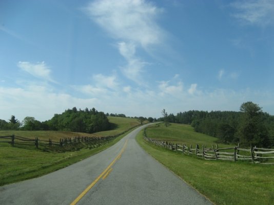
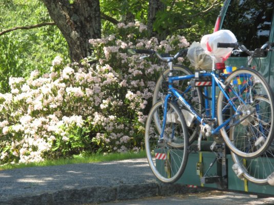
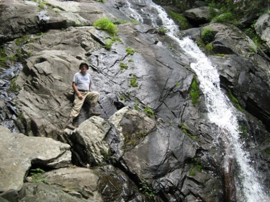
Day 14 June 2 Peaks of Otter NP CG, VA to Roanoke Mountain CG, VA
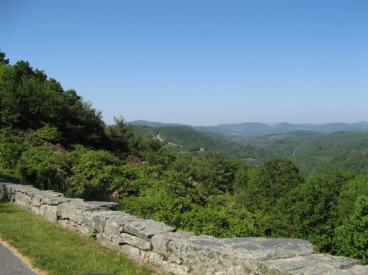
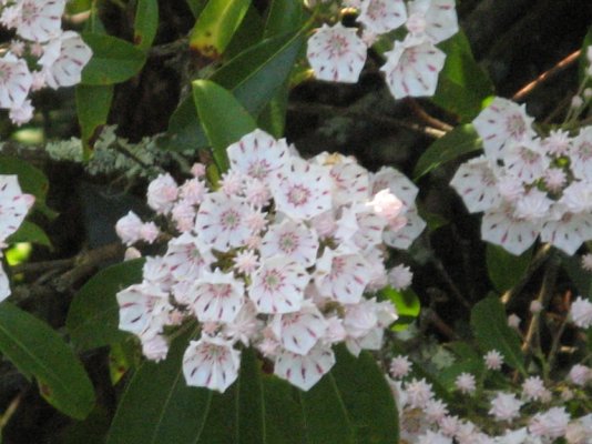
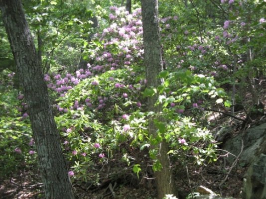
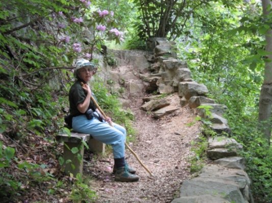
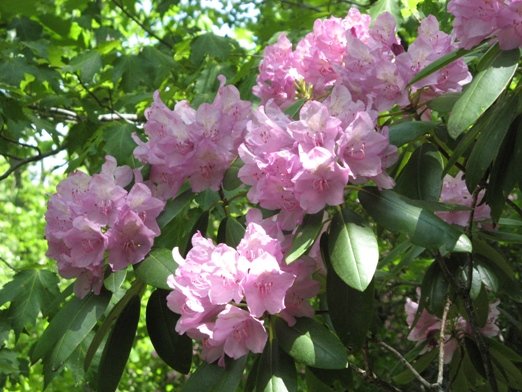
This morning was the start of a beautiful day. We woke up to a blue sky and bright sun streaming through the campground many trees. The temperature outside this morning was 580 and inside the van it was 650 and that was with both roof vents open all night and the rear vent on its lowest (10%) exhaust speed. We walked around the grounds and then had breakfast. We packed up and drove back to the Fallingwater Cascade Trail. The trail goes along the Fallingwater Creek with its huge rock outcrops that are covered with rhododendrons. The trail to the cascade is 2000 feet and drops 260 feet. Just have to remember what goes down also must come back up. The rhododendrons were in full bloom and were really think at the cascade itself. We just took our time coming back up and had a great time.
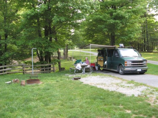
From there we took a leasurely drive on the parkway to Roanoke Mountain campground. It is similar to Peaks of Otter but not quite as hilly and it is a little less wooded. We found a shaded and flat enough site and paid for it. We then drove into Roanoke to do two weeks of laundry, get gas and ice.
Day 15 June 3 Roanoke Mt. CG to Rocky Knob CG, VA
The birds woke Joanne around 6:15 so after awhile she got up and had a walk around. After I got up we took an early morning walk together around the campground before breakfast. Of the sites on this loop only three were occupied over night. When we came back, we had breakfast and made preparations to leave.
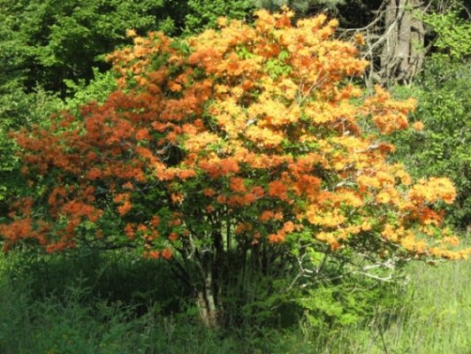
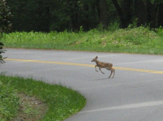
We saw more beautiful scenic views of valleys below us and now we are seeing farm lands because the surrounding land is not parkland. Some of them are very picturesque. Also the Flaming Azalea bushes along the roadway are amazing. They vary from a gold color to a very, very bright orange. At one point we stopped so we could get a picture of some plants and a mother deer and a fawn came out of the woods and after stopping in the middle of the road for awhile proceeded to it. Joanne got two really good pictures of them.
We had lunch at the mill restaurant and toured the very popular mill area. The mill itself is said to be one of the most photographed mills in the US. Edwin Mabrys built the mill in 1910 and used it as both a sawmill and a grist mill. He also had a woodworking shop run by the wheel. He fabricated much of the equipment himself using local wood or the local blacksmith shop. Other sights there included a frontier home, moonshine still, blacksmith, and sorghum evaporator. It was all quite interesting and we learned that when people spun wool into yarn they would wind it on a ?weasel.? To make a skein they wound it until they heard the weasel pop four times, once for every 10 times around, to give 240 feet of yarn. Pop! Goes the weasel!
It just started to rain as we were finishing up our tour there and backtracked to Rocky Knob Campground for the evening. Glad we have our awning to be outside a little. Our cell phone worked and we were able to talk to our daughter in Michigan for awhile. Campground host said cell phone reception is very spotty.
Holly smokes, it?s crowded here! Six sites are occupied tonight in the RV loop.
Day 16 June 4 Rocky Knob CG To Doughton Park, N. Carolina
This morning we went out for breakfast instead of eating at camp. We went back to the Mabry Restaurant for some pancakes. Joanne also wanted to talk to someone in the spinning house again to ask some questions about the ?weasel? so we walked back to the historical settlement area too.
The countryside continues to dazzle us with its beauty in flowers and scenery. We took some pictures of old run down barns and wondered what their histories are. We saw another mother deer and a fawn; this one looked younger than the one we saw yesterday.
We stopped by the Puckett cabin, the home of Orelena Hawks Puckett who was a midwife. She helped deliver over 1000 babies, yet none of her own 24 children survived infancy. The last delivery she worked on was in the last year of her life when she was 102 years old.
We exited the Blue Ridge at Fancy Gap to drive to a fabric store that some ladies at the restaurant had told Joanne about this morning. On the way back we drove by an old Victorian home setting on a hill. It was really neat and there was nothing in the area like it.
The Blue Ridge Music Center is new since the last time we drove this way so we decided to check it out. It was another fun and interesting stop. We listened to Bill and Maggie Anderson play and sing for a while and bought 2 of their CDs. When then toured the Music Center. It has displays covering local music groups from the 1920?s through 1940?s.
Our next stop was the Brinegar Farm. Martin and Caroline Brinegar lived and raised 3 children here in the late 1800s on their 120 acre farm. It must have been a hard life, but from what the information boards said, it was a good life for all of them.
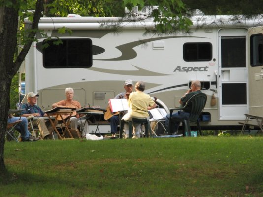
Our drive ended today at Doughton Park at about 3700 ft. When we were cleaning up after our supper, we heard music. There was a group of friends who get together to camp and pick every so often; we were lucky enough to be here at the same time. There were 6 people playing the fiddle, harmonica, Omniphone, guitars, and dulcimers. One man could play at least 3 of the instruments. One more person arrived and she played the spoons for a little while. It was really fun listening and talking to them. We spent at least an hour setting around and listening to them. What a nice way to relax and end the day?s activities.
Day 17 June 5 2nd Day Doughton Park, N. Carolina
We left camp in good time today to go on down the road to find a grocery store. We needed a Walmart type store to get a few more supplies than just bread and milk. We also wanted to find a place to receive a fax. We went to the post office in Jefferson for stamps and asked there if there was a place to receive faxes and the postal worker said she could. The Post Office cost was $1 per page and she did not charge use for the cover page.
When we were finished in Jefferson, we had to decide whether to travel on or go back to last night?s campground. I wanted to go back so we could listen to the folks picking again. We spent part of the afternoon chatting with the folks in the campground.
We used both the Dutch ovens tonight to make a meatloaf and an orange cranberry bread. After our supper, we went back over to the music site and listened to more pickin?. They started playing at 6:00pm and stopped when it was too dark to see sheet music anymore, about 9:15pm when got to dark to see the words. There was a woman there tonight singing that really had a good ?mountain? voice. We took the orange cranberry bread over to the music site when the music was over and everyone enjoyed the fresh bread. It was our contribution to the evening?s activity. We really had a good time standing around, eating and talking. I think those folks are national treasures and hope their talent is passed on to the next generation. Viola said they have an Appalachian music program in the schools so the kids can learn about it as well as how to play these instruments. Some of the other people home came over to hear the music were from Vermont and Montreal. We are really glad though that we stayed a second night at Doughton Park.
Day 18 June 6 Doughton Park CG To Linville Falls CG , NC
We were able to talk to most of the Appalachian singers and pickers from last night before we left. Wayne walked by and stopped a while; he?s so nice and fun to listen to with his Appalachian accent. ?Doc? Julian came by while we were at the dump station. Jo went up to talk to Don and Dot Shaddy from Columbia, S.C. while I was filling the water tank. Dot and Don came to see the inside of the van. Val and Bruce weren?t around. We said good bye and it seemed like we were leaving long time friends.
We stopped at Mt. Jefferson Overlook and saw that we had some signal bars so called our kids. We do miss having the correct adapter for our Wilson phone antenna. We have not talked to the kids for about 5 days.
E. B. Jeffress Park, the next overlook, had a waterfall: Cascades Falls, so we stopped to hike to it. It was an easy 30 minute trail (if you don?t stop and read the signs or stay to long at the falls) without a lot of climbing. The There were signposts all along the way explaining about the plant life. The falls were very pretty and worth the hour long walk. When we got back to the car, we had some lunch before moving on.
We visited the Moses H. Cone Memorial Park to look at the Craft Center. I talked to the woodworker who was putting on a joinery demonstration. There were many beautiful handmade things there, but nothing that really caught our eye and we wanted to buy.
We drove through Julian Price Campground, but it was a little early to stop. And anyway we didn?t see any sites we liked. So we continued on to Linville Falls campground. We can tell school is out because there are more people and kids. We also understand what our Appalachian singing friends meant when they said that Doughton Park is the nicest camp on the Parkway. Linville Falls is laid out very strangely with site crowded together in some areas and spread wide apart in others. It is Friday night and very hot in the low lands (90ish I have heard). The campground is about two thirds full and must of those sites have tents on them. As far as I can tell we are the only ones in the campground who have been traveling the Blue Ridge Pkwy. Linville Falls has a very strong local flavor.
Day 19 June 7 Linville Falls CG to Mt. Pisgah CG, Blue Ridge Parkway, NC
Last night we played a few rounds of Rummy Cube and then turned in. The temperature outside at 8:30pm was 77F and this morning at 6:30am it was a pleasant 65F. This was the first time we really used the automatic feature on the new Fantastic Fan. I set it for 72.5F when we went to bed. As the night progressed and the air cooled down the fan ran on slower and slower speeds until it finally shut off. On the lower speeds it is very quite. In the van our pillows are within 4 feet of the fan and we appreciate its low sound level.
We were on the Blue Ridge by 9:00am today and stopped at a scenic overlook to have breakfast. There was a 30 mile detour north of Ashland that put us on Route 226, then I-40 and back onto the parkway at Ashville. The first 3-5 miles of southbound Route 226 should be avoided. Hairpin turns at a very steep grade with trucks limited to 15mph maximum and many speed warnings. I was in 2nd gear and riding the brakes to keep my speed down. If I remember correctly, there was a small sign where the detour started that RV?s might want to consider taking 226 north to 19E rather than the ?normal? detour route.
When we got back onto the Blue Ridge at Ashville, we took it north for a mile to the Craft Center. The local artwork that is on display there is well presented and interesting. We did buy a little bit of glass while there.
We are spending the night at the Mt. Pisgah Campground. It has three loops. ?A? loop for larger RV?s, ?B? loop for vans and pop ups, and ?C? & ?D? loops for tents. ?A? loop was about 1/3 full so we are staying on ?B? loop that is mostly empty. The restroom on ?B? loop has been torn down and plans are to replace it with one that also has showers.
We found a nice quiet site, made a fire and cooked bratwursts for supper. It rained and thundered a bit, but it didn?t last too long. Let it rain at night and get it out of its system; then be dry for our daytime driving and sightseeing. We needed some exercise so we went for a walk after supper to check out the other sites and people?s rigs.
Day 20 June 8 Mt. Pisgah CG to Corbin KOA, Kentucky near I-75
It rained a little last night and then the weather broke. It was 62F outside this morning. Bright, sunny and the air was dry. It was a great morning to wake up to. We got tide up with a bird this morning. It took us (mainly Joanne that is) about an hour and half to track down a bird we heard singing and to identify it. Two of them really helped us by flying in and out of the bushes around our campsite and singing to each other. After a couple mis-identifications Joanne tied them down as Blue Headed Vireos. It required both her Selby?s Bird Book used for initial identification and then the Thayer eField Guide on the computer to match the song. It was really fun and Joanne got to add a new bird to her life list. Her life list now has 193 birds on it.
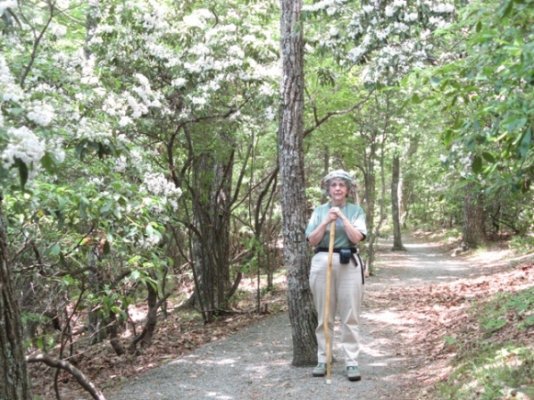
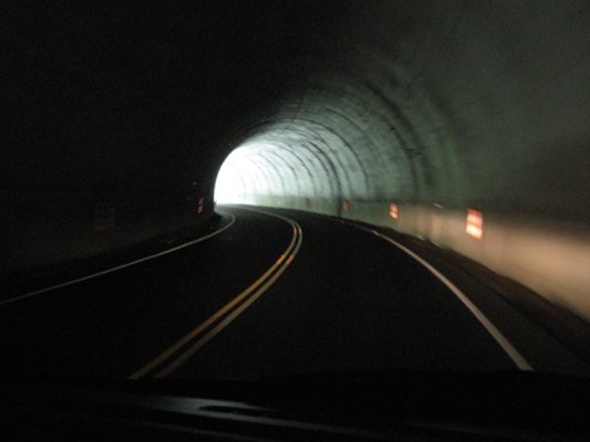
The mountains were beautiful this morning. Rhododendron flowers were really thick at the start of the Blue Ridge in Virginia but white and pink Mountain Laurel flowers are thick here in southern North Carolina. The reverse is true about road tunnels. There were very few for most of the trip. These last two days though we must have gone through a dozen or more of them. Always concerned about coming up on a bike rider in one of them. It is very bright outside and when you first enter the unlit tunnel you are nearly blind for a second or two. The shoulders in the tunnels are very narrow and in most cases covered with road debris so cyclist would be riding well into the traffic lane. So there is always the concern about not seeing a cyclist soon enough, or having to pull into the oncoming traffic lane in a narrow tunnel to pass him/her, or slowing way down and getting rear ended by another vehicle coming into the tunnel. Have never had a problem but my alert level went way in each of those many tunnels.
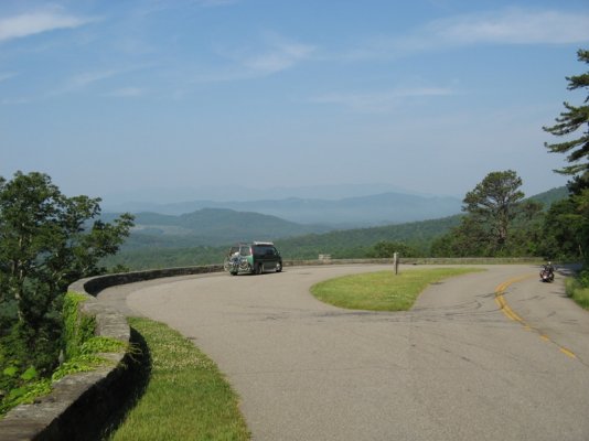
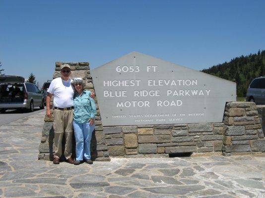
We stopped several of the pull offs and of course at the highest point on the parkway. The highest point is at the 431 mile marker is 6047 feet above sea level. No it is not nearly as high as that newer mountain range called the Rockies. It must be remembered though that these very old rounded over mountains are many, many years older and in there heyday were even higher than the Rockies. Time marches on.
With our camera and memories full of great views and heat wave that is going through the south we decided to head for the barn. We will see the Blue Ridge Parkway through to the end at Cherokee and then cut across the top of The Great Smoky Mountain National Park on Route 441. The last scenic overlook will be at the top of the Smoky Mountains at the North Carolina Tennessee border at the elevation of 5048 feet.
We stopped there along with 100 or so other people for the typical picture of the sign. We took the bypass around Gatlinburg to avoid the traffic, but found more in Pigeon Forge. The road was lined with hotels, motels, carnival rides, tourist traps, etc. Finally we got on to the I-40 expressway heading west towards I-75.
Our planned stop for the night is at the Corbin KOA. Hope they have a lot of shade!
The Corbin KOA is very nice. It?s sites are well spaced and most have varying degrees of shade, The grounds and facilities are very clean and maintained. It has a pool and good WiFi. Corbin: Home of Kentucky Killed Fried Chicken, Cumberland Falls, near Berea Folk Arts and Craft Center, the Cumberland Gap, and Fort Boonesborough.
It is 88F in Corbin?..So as we jump into the KOA pool we will consider this to be the end of our 20 day trip.
This morning was the start of a beautiful day. We woke up to a blue sky and bright sun streaming through the campground many trees. The temperature outside this morning was 580 and inside the van it was 650 and that was with both roof vents open all night and the rear vent on its lowest (10%) exhaust speed. We walked around the grounds and then had breakfast. We packed up and drove back to the Fallingwater Cascade Trail. The trail goes along the Fallingwater Creek with its huge rock outcrops that are covered with rhododendrons. The trail to the cascade is 2000 feet and drops 260 feet. Just have to remember what goes down also must come back up. The rhododendrons were in full bloom and were really think at the cascade itself. We just took our time coming back up and had a great time.
From there we took a leasurely drive on the parkway to Roanoke Mountain campground. It is similar to Peaks of Otter but not quite as hilly and it is a little less wooded. We found a shaded and flat enough site and paid for it. We then drove into Roanoke to do two weeks of laundry, get gas and ice.
Day 15 June 3 Roanoke Mt. CG to Rocky Knob CG, VA
The birds woke Joanne around 6:15 so after awhile she got up and had a walk around. After I got up we took an early morning walk together around the campground before breakfast. Of the sites on this loop only three were occupied over night. When we came back, we had breakfast and made preparations to leave.
We saw more beautiful scenic views of valleys below us and now we are seeing farm lands because the surrounding land is not parkland. Some of them are very picturesque. Also the Flaming Azalea bushes along the roadway are amazing. They vary from a gold color to a very, very bright orange. At one point we stopped so we could get a picture of some plants and a mother deer and a fawn came out of the woods and after stopping in the middle of the road for awhile proceeded to it. Joanne got two really good pictures of them.
We had lunch at the mill restaurant and toured the very popular mill area. The mill itself is said to be one of the most photographed mills in the US. Edwin Mabrys built the mill in 1910 and used it as both a sawmill and a grist mill. He also had a woodworking shop run by the wheel. He fabricated much of the equipment himself using local wood or the local blacksmith shop. Other sights there included a frontier home, moonshine still, blacksmith, and sorghum evaporator. It was all quite interesting and we learned that when people spun wool into yarn they would wind it on a ?weasel.? To make a skein they wound it until they heard the weasel pop four times, once for every 10 times around, to give 240 feet of yarn. Pop! Goes the weasel!
It just started to rain as we were finishing up our tour there and backtracked to Rocky Knob Campground for the evening. Glad we have our awning to be outside a little. Our cell phone worked and we were able to talk to our daughter in Michigan for awhile. Campground host said cell phone reception is very spotty.
Holly smokes, it?s crowded here! Six sites are occupied tonight in the RV loop.
Day 16 June 4 Rocky Knob CG To Doughton Park, N. Carolina
This morning we went out for breakfast instead of eating at camp. We went back to the Mabry Restaurant for some pancakes. Joanne also wanted to talk to someone in the spinning house again to ask some questions about the ?weasel? so we walked back to the historical settlement area too.
The countryside continues to dazzle us with its beauty in flowers and scenery. We took some pictures of old run down barns and wondered what their histories are. We saw another mother deer and a fawn; this one looked younger than the one we saw yesterday.
We stopped by the Puckett cabin, the home of Orelena Hawks Puckett who was a midwife. She helped deliver over 1000 babies, yet none of her own 24 children survived infancy. The last delivery she worked on was in the last year of her life when she was 102 years old.
We exited the Blue Ridge at Fancy Gap to drive to a fabric store that some ladies at the restaurant had told Joanne about this morning. On the way back we drove by an old Victorian home setting on a hill. It was really neat and there was nothing in the area like it.
The Blue Ridge Music Center is new since the last time we drove this way so we decided to check it out. It was another fun and interesting stop. We listened to Bill and Maggie Anderson play and sing for a while and bought 2 of their CDs. When then toured the Music Center. It has displays covering local music groups from the 1920?s through 1940?s.
Our next stop was the Brinegar Farm. Martin and Caroline Brinegar lived and raised 3 children here in the late 1800s on their 120 acre farm. It must have been a hard life, but from what the information boards said, it was a good life for all of them.
Our drive ended today at Doughton Park at about 3700 ft. When we were cleaning up after our supper, we heard music. There was a group of friends who get together to camp and pick every so often; we were lucky enough to be here at the same time. There were 6 people playing the fiddle, harmonica, Omniphone, guitars, and dulcimers. One man could play at least 3 of the instruments. One more person arrived and she played the spoons for a little while. It was really fun listening and talking to them. We spent at least an hour setting around and listening to them. What a nice way to relax and end the day?s activities.
Day 17 June 5 2nd Day Doughton Park, N. Carolina
We left camp in good time today to go on down the road to find a grocery store. We needed a Walmart type store to get a few more supplies than just bread and milk. We also wanted to find a place to receive a fax. We went to the post office in Jefferson for stamps and asked there if there was a place to receive faxes and the postal worker said she could. The Post Office cost was $1 per page and she did not charge use for the cover page.
When we were finished in Jefferson, we had to decide whether to travel on or go back to last night?s campground. I wanted to go back so we could listen to the folks picking again. We spent part of the afternoon chatting with the folks in the campground.
We used both the Dutch ovens tonight to make a meatloaf and an orange cranberry bread. After our supper, we went back over to the music site and listened to more pickin?. They started playing at 6:00pm and stopped when it was too dark to see sheet music anymore, about 9:15pm when got to dark to see the words. There was a woman there tonight singing that really had a good ?mountain? voice. We took the orange cranberry bread over to the music site when the music was over and everyone enjoyed the fresh bread. It was our contribution to the evening?s activity. We really had a good time standing around, eating and talking. I think those folks are national treasures and hope their talent is passed on to the next generation. Viola said they have an Appalachian music program in the schools so the kids can learn about it as well as how to play these instruments. Some of the other people home came over to hear the music were from Vermont and Montreal. We are really glad though that we stayed a second night at Doughton Park.
Day 18 June 6 Doughton Park CG To Linville Falls CG , NC
We were able to talk to most of the Appalachian singers and pickers from last night before we left. Wayne walked by and stopped a while; he?s so nice and fun to listen to with his Appalachian accent. ?Doc? Julian came by while we were at the dump station. Jo went up to talk to Don and Dot Shaddy from Columbia, S.C. while I was filling the water tank. Dot and Don came to see the inside of the van. Val and Bruce weren?t around. We said good bye and it seemed like we were leaving long time friends.
We stopped at Mt. Jefferson Overlook and saw that we had some signal bars so called our kids. We do miss having the correct adapter for our Wilson phone antenna. We have not talked to the kids for about 5 days.
E. B. Jeffress Park, the next overlook, had a waterfall: Cascades Falls, so we stopped to hike to it. It was an easy 30 minute trail (if you don?t stop and read the signs or stay to long at the falls) without a lot of climbing. The There were signposts all along the way explaining about the plant life. The falls were very pretty and worth the hour long walk. When we got back to the car, we had some lunch before moving on.
We visited the Moses H. Cone Memorial Park to look at the Craft Center. I talked to the woodworker who was putting on a joinery demonstration. There were many beautiful handmade things there, but nothing that really caught our eye and we wanted to buy.
We drove through Julian Price Campground, but it was a little early to stop. And anyway we didn?t see any sites we liked. So we continued on to Linville Falls campground. We can tell school is out because there are more people and kids. We also understand what our Appalachian singing friends meant when they said that Doughton Park is the nicest camp on the Parkway. Linville Falls is laid out very strangely with site crowded together in some areas and spread wide apart in others. It is Friday night and very hot in the low lands (90ish I have heard). The campground is about two thirds full and must of those sites have tents on them. As far as I can tell we are the only ones in the campground who have been traveling the Blue Ridge Pkwy. Linville Falls has a very strong local flavor.
Day 19 June 7 Linville Falls CG to Mt. Pisgah CG, Blue Ridge Parkway, NC
Last night we played a few rounds of Rummy Cube and then turned in. The temperature outside at 8:30pm was 77F and this morning at 6:30am it was a pleasant 65F. This was the first time we really used the automatic feature on the new Fantastic Fan. I set it for 72.5F when we went to bed. As the night progressed and the air cooled down the fan ran on slower and slower speeds until it finally shut off. On the lower speeds it is very quite. In the van our pillows are within 4 feet of the fan and we appreciate its low sound level.
We were on the Blue Ridge by 9:00am today and stopped at a scenic overlook to have breakfast. There was a 30 mile detour north of Ashland that put us on Route 226, then I-40 and back onto the parkway at Ashville. The first 3-5 miles of southbound Route 226 should be avoided. Hairpin turns at a very steep grade with trucks limited to 15mph maximum and many speed warnings. I was in 2nd gear and riding the brakes to keep my speed down. If I remember correctly, there was a small sign where the detour started that RV?s might want to consider taking 226 north to 19E rather than the ?normal? detour route.
When we got back onto the Blue Ridge at Ashville, we took it north for a mile to the Craft Center. The local artwork that is on display there is well presented and interesting. We did buy a little bit of glass while there.
We are spending the night at the Mt. Pisgah Campground. It has three loops. ?A? loop for larger RV?s, ?B? loop for vans and pop ups, and ?C? & ?D? loops for tents. ?A? loop was about 1/3 full so we are staying on ?B? loop that is mostly empty. The restroom on ?B? loop has been torn down and plans are to replace it with one that also has showers.
We found a nice quiet site, made a fire and cooked bratwursts for supper. It rained and thundered a bit, but it didn?t last too long. Let it rain at night and get it out of its system; then be dry for our daytime driving and sightseeing. We needed some exercise so we went for a walk after supper to check out the other sites and people?s rigs.
Day 20 June 8 Mt. Pisgah CG to Corbin KOA, Kentucky near I-75
It rained a little last night and then the weather broke. It was 62F outside this morning. Bright, sunny and the air was dry. It was a great morning to wake up to. We got tide up with a bird this morning. It took us (mainly Joanne that is) about an hour and half to track down a bird we heard singing and to identify it. Two of them really helped us by flying in and out of the bushes around our campsite and singing to each other. After a couple mis-identifications Joanne tied them down as Blue Headed Vireos. It required both her Selby?s Bird Book used for initial identification and then the Thayer eField Guide on the computer to match the song. It was really fun and Joanne got to add a new bird to her life list. Her life list now has 193 birds on it.
The mountains were beautiful this morning. Rhododendron flowers were really thick at the start of the Blue Ridge in Virginia but white and pink Mountain Laurel flowers are thick here in southern North Carolina. The reverse is true about road tunnels. There were very few for most of the trip. These last two days though we must have gone through a dozen or more of them. Always concerned about coming up on a bike rider in one of them. It is very bright outside and when you first enter the unlit tunnel you are nearly blind for a second or two. The shoulders in the tunnels are very narrow and in most cases covered with road debris so cyclist would be riding well into the traffic lane. So there is always the concern about not seeing a cyclist soon enough, or having to pull into the oncoming traffic lane in a narrow tunnel to pass him/her, or slowing way down and getting rear ended by another vehicle coming into the tunnel. Have never had a problem but my alert level went way in each of those many tunnels.
We stopped several of the pull offs and of course at the highest point on the parkway. The highest point is at the 431 mile marker is 6047 feet above sea level. No it is not nearly as high as that newer mountain range called the Rockies. It must be remembered though that these very old rounded over mountains are many, many years older and in there heyday were even higher than the Rockies. Time marches on.
With our camera and memories full of great views and heat wave that is going through the south we decided to head for the barn. We will see the Blue Ridge Parkway through to the end at Cherokee and then cut across the top of The Great Smoky Mountain National Park on Route 441. The last scenic overlook will be at the top of the Smoky Mountains at the North Carolina Tennessee border at the elevation of 5048 feet.
We stopped there along with 100 or so other people for the typical picture of the sign. We took the bypass around Gatlinburg to avoid the traffic, but found more in Pigeon Forge. The road was lined with hotels, motels, carnival rides, tourist traps, etc. Finally we got on to the I-40 expressway heading west towards I-75.
Our planned stop for the night is at the Corbin KOA. Hope they have a lot of shade!
The Corbin KOA is very nice. It?s sites are well spaced and most have varying degrees of shade, The grounds and facilities are very clean and maintained. It has a pool and good WiFi. Corbin: Home of Kentucky Killed Fried Chicken, Cumberland Falls, near Berea Folk Arts and Craft Center, the Cumberland Gap, and Fort Boonesborough.
It is 88F in Corbin?..So as we jump into the KOA pool we will consider this to be the end of our 20 day trip.
Attachments
-
 Day 14 - Boys Are Boys.jpg185.5 KB · Views: 29
 -
 Day 14 - Fallingwater Cascade Trail.jpg203.7 KB · Views: 26
 -
 Day 14 - Rest Stop On Trail.jpg181.1 KB · Views: 30
 -
 Day 14 - Rhododendron branch.jpg141 KB · Views: 27
 -
 Day 15 - Bright Flame Azalia.jpg209.1 KB · Views: 23
 -
 Day 15 - Fawn Xing Road.jpg201.1 KB · Views: 27
 -
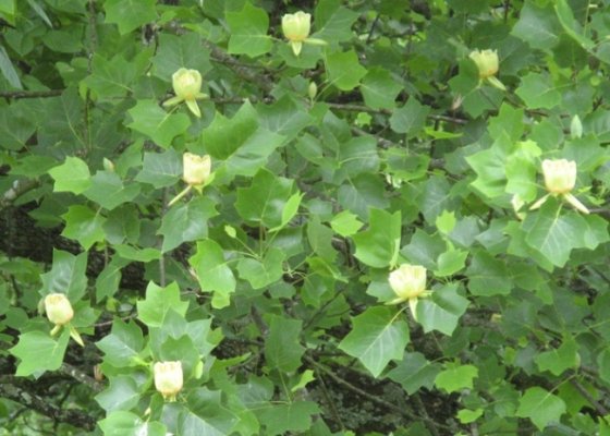 Day 15 - Tulip Tree Flowers.jpg171.5 KB · Views: 26
 -
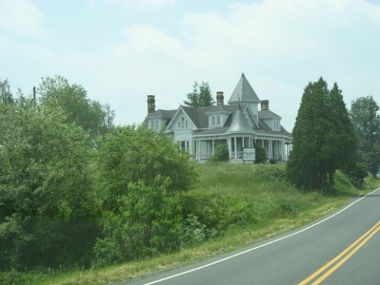 Day 16 - Big Old House.jpg109.4 KB · Views: 24
 -
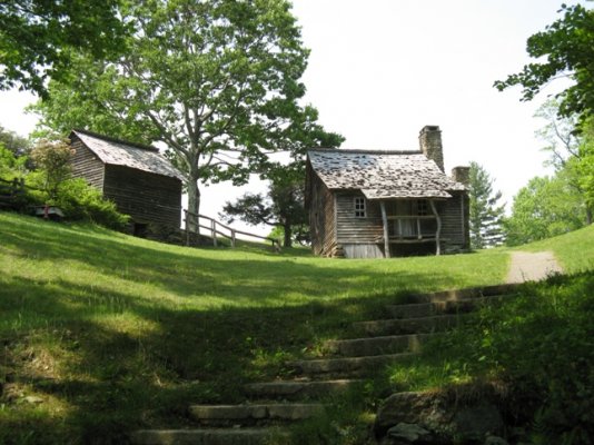 Day 16 - Brinegar Home in Woods.jpg206.7 KB · Views: 28
 -
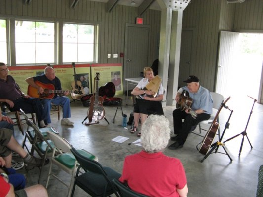 Day 16 - Music Ctr.jpg144.9 KB · Views: 30