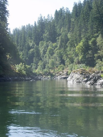
Valley of The Rogue River
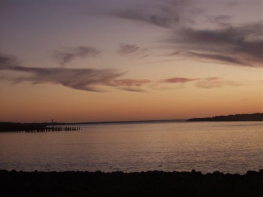
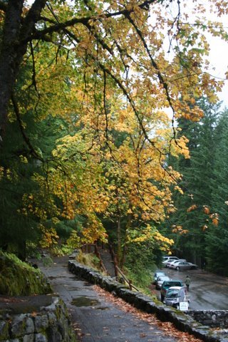
We waved our good-byes to the ?party animals? Escapees group on Wednesday morning heading to Valley of the Rogue State Park. I had a back up plan if we could not fit in the state campground or find a sight that was satellite friendly. As Tim dumped the motorhome, I scouted out a couple of camping sites we thought might work. With compass in hand, I faced southeast and tried to make sure there were no trees. We ended up in a great spot. This campground has large sites, very RV friendly and it?s been a really nice place to stay. However there are trees, so it maybe difficult for satellites. They have a lot of open space outside the camping sites with trails and places to take dogs. Plus, blackberries are everywhere and I can?t go very many steps without sampling a few. The campground parallels the Rogue River; but interstate 5 is also close. A couple of times we?ll hear the exhaust brake on a trucker.
Thursday we had a look around, did grocery shopping and little domestic stuff. We also found a good rain coat for Tim. His old one just wasn?t doing the job. Our reason for camping here at Valley of the Rogue is that we could take day trips to both the Oregon Caves National Monument and Crater Lake National Park. We could also scout out the salmon/steelhead fishing in Shady Cove. So, it was fairly central to things we wanted to do; plus we are saving diesel fuel by not doing so much driving in the coach.
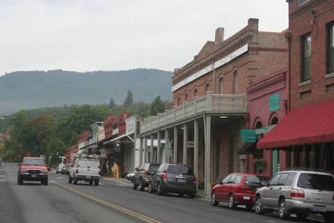
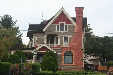
In doing my research, I found that there is a quaint little town near here that is on the National Historic list. It?s called Jacksonville. Off we headed Friday morning in a light drizzly rain. It is a very cute town with old Victorian houses. They also have a new housing development where the homes are built to look like ?ginger bread homes? and old Victorians. It was actually quaint with the downtown part looking like an old western cow town. When we looked at the map we were trying to make a driving loop from Jacksonville to Oregon Caves. We punched the address into ?Garmin Jill? and voila` we were off. When I looked at the paper map, it looked like a much longer distance from Jacksonville to the Caves than what good ol` Garmin Jill was giving us. We gave it some thought then decided to trust Jill. The roads were good starting off and it was fun driving through the back roads of Southern Oregon; then the road went to a one lane forest road and finally about 5 miles from the Caves it went to muddy gravel; not to mention the road was steadily climbing the mountain. Our little Hyundai Tucson does not have 4 wheel drive; although it does have high clearance. We looked at each other and said?forget it, we are not gonna get stuck out here with no cell service and gawd forbid?no food.
")
If we would have been in Tim?s 4 wheel drive Chevy truck, we probably would have tackled it.
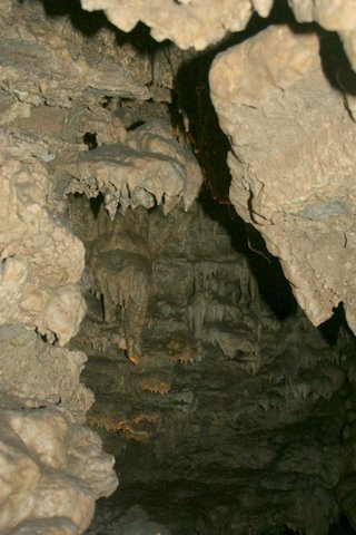
Turned around, retraced our route and drove to the Caves via regular highways. We got there in plenty of time. The Caves are very nice and well worth our double attempt at reaching them. When we bought our tour tickets, I mentioned that our GPS gave a route to the caves via forest service roads. The ranger said that lots of people came in that way. So, Jill, was somewhat right. ;D
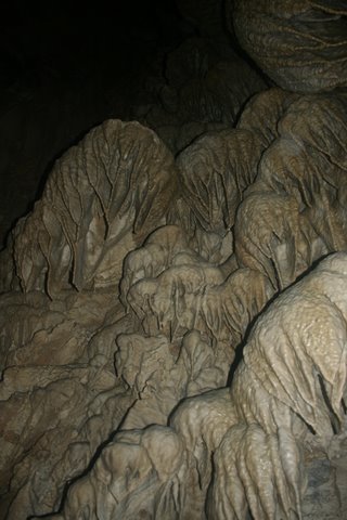
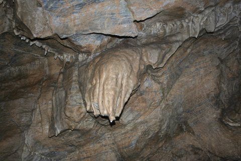
The tour is about 1 ? hour long. The significance of this cave is that there is a lot of calcite resulting in a lot of marble in the cave; which was evident. The tour involved some scooting under rock ledges, as well as, climbing lots of stairs. We found it fascinating. For Tim and I who have sat around a great deal this last year, it was not strenuous at all. There is a lodge which was built in 1932.
The next morning, Saturday, we packed a picnic and headed to Crater Lake. We were hoping perhaps the rain would clear and kept our fingers crossed the entire 70 some miles one way while driving in moderate rain. We are such ?hopefully people?the glass is always half full? or maybe the truth is we love adventures.
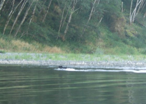
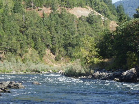
On the way to Crater Lake, there is a pull off where you can see the ?Rogue Gorge?. It?s a relatively small canyon/gorge where the Rogue River squeezes through and shoots out the end of the canyon with extreme force. The water flows at 400,000 cubic feet per minute, which would fill an Olympic swimming pool in about a minute?s time.
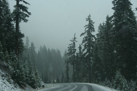
Finally we reached the entrance to Crate Lake N.P. where I got to use my brand new ?senior? pass for the parks system. Wahoo! Getting older does have some benefits. We drove to the Visitor?s Center and watched a short video on the history of the lake. As we exited the video room, I looked through the large picture window and saw very big snow flakes falling. Stupid me, asked if it was snow?.the rangers thought I?d lost my sanity?of course its snow. De java vu?get so close then miss it. The ?look out? was only 3 miles, but it was up the mountain. Tim and I being adventurous souls decided to go have a look anyway and when we got there couldn?t see a blasted thing. But hey, we are troopers and gave it our best shot. The gift center at the look out was open, and the coffee good.
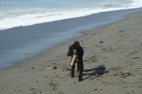
On the way back down we stopped at a ?Sno-Park?. Now for those of you who don?t know what a snow park is, it?s a large parking area for people with snow mobiles, or as Sarah Palin calls them, ?Snow Machines?. Sno Parks are also trail heads. We donned our rain gear (we had driven down to below the snow line) and took Charlie, the poodle puppy for a hike, as the poor puppy had spent nearly 2 days in the car. He was thrilled.
Today, Sunday, we are still in Valley of the Rogue. Tomorrow we are driving a total distance of 35 miles to Ashland, Or. Ashland, is known for it?s Shakespeare plays and other events. We aren?t sure what is or isn?t going on; but we wanted to walk the town and check it out.
As for the salmon/steelhead fishing, I guess we are just plain out of luck. The fish are not running and we are a bit too early. And to be honest Tim and I weren?t sure we wanted to sit in a boat with pouring down rain in the hopes of catching one. Are we wimps or what?
Marsha~