Our Grand Alasakan Adventure

The friendliest place on the web for anyone with an RV or an interest in RVing!
If you have answers, please help by responding to the unanswered posts.
The story with Sam McGee was that Robert Service, the author, after hearing the name of Sam McGee sounded better than what he was using and asked permission from Sam McGee, who was a prospector, and he said yes.  It is totally made up.
June 10, 2014 ?Day 21

We are up early, we are so excited for Megan to arrive this afternoon.  We started off at the Beringia Centre.  Very interesting, I had thought when the last ice age occurred that all of the northern hemisphere was under snow/ice.  What we learned was there was a land mass that was part of Russia, Alaska and Yukon that were not totally covered in ice and snow and this area was called Beringia.  When the glacier formed over North America it drew up so much water, the level of the ocean dropped enough to expose dry land connecting Alaska/Yukon to Siberia.  Animals and humans migrated over.  There were Wholly Mammoths, Scimitar cat, Giant Ground Slough, Musk Ox, Yukon horses, Saiga Antelope, who had big noses to help heat the air they breathed.  It was very interesting.
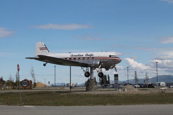
Then we headed next door to the Transportation Museum.  They had everything from snow shoes to moose skin boats to dog sleds and stages coaches.  Pioneer aircraft, railroad items, riverboat and old military vehicles that helped to build the wartime Alaska Highway.  Out front is a full size plane that is centered perfectly and used as a weather vane.  With frequent checks of time on our watches we had about 30 mins to wait for Megan to arrive.  Had a quick sandwich and watched as her plane landed.
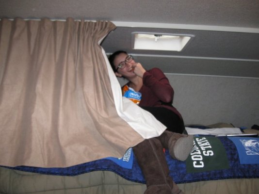
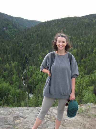
Met her at the gate, since they only use 2 gates, rounded up luggage and back to WeBe to feed her a little late lunch.  Took Megan back into town with a stop at the Miles Canyon and the suspension bridge.  Drove up Main Street and back to the SS Klondike for it tour and video.  Wind had really picked up and made it chilly.  Stopped in Klondike Ribs and Salmon for a very delicious meal.  With tummies full and a little time to kill we walked to the Visitor Centre for Meg?s to watch the video there and then walked to Mac?s Fireweed book store.  Browsed and bought a couple of Christmas presents and then went over to the Westmark Hotel for a drink and then the Frantic Follies show.  A vaudeville review with slap stick jokes, but it was fun.  Now it is way past our bedtime so I?ll just say TTFN.

 
You all are having too much fun. I love reading about your adventures. I can't believe you had a radio program from Colorado Springs!!!!! What a hoot.  Tell Megs hi for me.  Next Wed  I have Mason duty. I'm looking forward to coloring. I'll give him hugs and kisses from you.  Love you guys and be safe.
 
June 12, 2014 ? Day 23
What a long hard day.  We left Kluane around 9 AM and began what could possibly be the hardest day drive.  Per the Milepost from Burwash Landing, Yukon to Beaver Creek, Yukon was nothing but frost heaves and potholes.  Jim maybe did 40 MPH max with many places that we only did 5-10 MPH for 130+ miles.  It rattled the fillings in my teeth. But I kept on sewing the binding on a quilt. Just don?t ask why my stitches are not even (they haven?t ever been but you didn?t know that).  It was even more difficult to thread a needle with all the swaying and bouncing around.  In total today we drove 252 miles.  We crossed the border and gave up our apples to the broader patrol, dang it.  But not the cookies we got at Buckshot Betty?s. The Border Patrol was very impressed by Megan?s passport. It is a little worn with her back and forth from Australia and her little around the world jaunt last year. The road improved with only a few frost heaves.  Partly cloudy skies all day and a temperature in the low 60?s, I guess.  Still lots of trees and lakes, but we did see a grizzly bear munching on the side of the road.  We snap a few pics.
Pulled into Tok RV Village around 3:45 PM and they had warm cookies at the check in desk and who could walk past a soft chocolate chip cookie (we still had ? of our cookies left from Buckshot Betty?s).  Site #810, lots of campsites with small, skinny pines trees in between sites but we do have a forest of trees in front since we are the last row.  Megan and I headed to the grocery store for some more fruit and Megan had to get a bag of Cheetos (they don?t have them in Australia). When we got to the car she was opening the bag and saying ?Just a few right now?.  Then to the liquor store for some wine to toast our arrival. Megan and I sit here with dueling computers while Jim has been sitting outside reading.  Megan is acting very strange and keeps getting into her backpack on the cab-over bed and I got to laughing so hard because I thought she had stashed the Cheetos up there.  We were laughing so hard we had tears running down our faces.  I think we need a day off from driving. All kidding aside she is great to travel with.  Better make some Sleepytime tea, so TTFN.
 

Attachments

  • AK-6-12 022 (640x480).jpg
    AK-6-12 022 (640x480).jpg
    242.3 KB · Views: 84
  • AK 6-12-2 005 (640x427).jpg
    AK 6-12-2 005 (640x427).jpg
    208.1 KB · Views: 59
I know I am going backwards here but I wanted to put in a pic of the airplane weathervane in Whitehorse.
 

Attachments

  • AK 6-12-2 001 (640x427) (640x427).jpg
    AK 6-12-2 001 (640x427) (640x427).jpg
    140.4 KB · Views: 60
Megan's Cheetos's fix!!! He He
 

Attachments

  • AK-6-12 031 (640x480).jpg
    AK-6-12 031 (640x480).jpg
    147.3 KB · Views: 71
  • AK-6-12 032 (640x480).jpg
    AK-6-12 032 (640x480).jpg
    155.3 KB · Views: 78
Mick and Jim  your picture is great. Now everyone knows what you look like.  I thought I recognized those boots on Megs. Sneaky little devil!!!  Love the grizzly.
Love you

 
Love your tee shirts of a bear carrying your camper away. 
So glad Megan made it to you all safe and sound.  You all will have so much fun.
Toodles,
Renee
 
June 13, 2014 ? Day 24
Choice for today was a trip up to Chicken, AK (pop 35-50).  While washing up from breakfast our water source stopped and Jim went up to office and was told that a camper started to drive off with all the water and electricity attached.  A major repair was in order and the guy who did this said he was a pilot and was use to walking around his plane to check that all systems were a go.  I hope I am never on one of his planes. After loading up the cooler with snacks and water we stopped at the Visitor Center here in Tok to check the road conditions.  The nice lady said there were a few frost heaves and some gravel areas, with the last couple of miles into Chicken were dirt/gravel.  Nice drive up, about 80 miles and the roads were as indicated by the lady in the Visitor Center.  Made it by 1 PM and went to The Chicken Creek Caf? for lunch.  Things were starting to hop in this place as ?Chicken Stock? was slated to start around 3 PM. Lots of people with tents, trailers, motorhomes and several people on bicycles to attend the 3 day music festival.  After lunch we went to the Gold Camp RV park/gold panning place (also where Chicken Stock was taking place), panned for gold while listening to a band play and great people watching.  There were people of all ages.  They were set for a great weekend.  Jim was the only successful one gold panning with one small flake of gold.  Bought a few souvenirs, we headed back to Tok.  Saw 4 moose, one was a relative new one. Wanted to take a walk but it started to rain, I guess we will have to have some cheese and crackers with our wine instead.  TTFN
 
Finally had a chance to read your stories and check out the pics. Glad you all are having such a great time. Lots of memories!!  Roger and I send our love, Annie
 
Hi all,

Hope the trip continues to be good.  Mick,  just wanted to let you know "Wind's come up".  It has been super muggy here this week and windy!  Renee and I went to McPherson last Friday.  Only 4 or 5 redheads, but some ducks have nested and splashed down in the pool a couple of times - that's been our wildlife sighting this summer.  TaTa

AP
 
June 14, 2014 ? Day 25
Not much to write about today.  Cool, very wet day.  Megan and I stayed in and read, sewed and napped.  Jim went out to the Little Tok River to try his luck.  The river was high and moving really fast.  Not good for fishing, he didn?t even get a bite.  So back to WeBe he came and he took a nap too.  Megan and I felt like we needed to get out, so we headed to the liquor store and made a purchase.  We are heading to Chitina tomorrow and there isn?t much around there.  The rain stopped briefly and we all headed out for a walk before it started to rain again.  Made a few phone calls, had dinner and watch a movie.  Nice, relaxing day.  TTFN
 
June 15, 2014 ? Day 26
Happy Father?s Day
A really late start today.  Went to put gas and propane in WeBe and the gentleman helping with the propane said our tire looked low, so he and Jim messed with the tire trying to put air in but difficult with the dually wheels on the back of WeBe.  Couldn?t get them filled and so the man called the tire store on the other side of town and he was open and over we went. This tire store also was a gas station and this guy was the only one working and it took about 45 mins total to put air in the tires, so, like I said a really slow start to the day.  We drove 203 miles to the little town of Chitina.  We are at the Wrangell View RV Park.  It is owned by a Native Alaskan Tribe.  It is a little scary to say the least.  Campsites poorly laid out and not enough room to maneuver.  There are only 12 campsites and we thought we were the only ones here but then a full timer came back to his trailer, that we thought was abandoned.  A few people have come in and not been able to level their motorhomes and they just left. But we did see a moose walk about 100 yards from the campsite.  The drive was really hard today, lots of frost heaves coming south on the Tok Cutoff to the Richardson Highway. But beautiful scenery.  The Wrangell range with Mount Drum (12,000+ ft) and Mount Sanford (16,000+ ft). Stopped in the Visitor Center for Wrangell ?St Elias National Park and Preserve (got a stamp in my Parks Passport), it is the largest national park in acreage. Mostly Cloudy but a few periods of sun.  Saw a couple more black bears, one being a cub.  Decided we would stay a few nights here, so set up camp, made dinner and went for a short drive down to the Copper River.  Lots of people fishing with dip nets and a few fish wheels were going.  You must be a resident of Alaska to do either of those two types of fishing.
Dip net fishing is where someone is in the flowing water with a huge net and dips it in the water to just scoop up the salmon.  And the fish wheel is like a ferris wheel, but as it turns the baskets go down into the water and if there is a fish it will go into the trough like thing.  The water is very silty and doesn?t make it easy to see fish.
Lost again at cards (Snarf), yuck, I hate losing.  Guess we will call it a night.  I think we will sleep with the shotgun loaded tonight.  TTFN
 

Attachments

  • AK 6-15-2 013 (640x427).jpg
    AK 6-15-2 013 (640x427).jpg
    201.1 KB · Views: 58
  • AK 6-15-2 005 (640x427).jpg
    AK 6-15-2 005 (640x427).jpg
    158.2 KB · Views: 45
June 16, 2014 ? Day 27
Well, we survived the night.  Megan has named the resident camper Richard and we have spent some time concocting a story about why he lives in this remote location.  She has grown affectionately towards this young man. We have decide to trade her for 20 Yaks (there is a Yak farm up the road).  We do have fun with her.  And I personally think she has seen or read too many movies or books.  Checked out Liberty Falls this morning on our way for a hike on the Tosonia Trail.  After we applied the 2 tons of insect spray on our persons we set out.  About 10-15 minutes into the hike we came to kind of, sort reminded us of a swamp.  Mosquitoes were so thick we turned around and decided a nice drive would do.  Drove the Old Edgerton Highway, which was a dirt road.  In fact it was a better dirt road than the new paved Edgerton Highway.  Thought we might see wildlife but all we saw was a dog in a driveway.  There were some nice houses tucked back in there.  We came out on the Richardson Highway a few miles north of where you turn off for the Edgerton Highway.  Sat at road construction waiting for the pilot car.  The young lady holding the stop sign was more interested in texting and fiddling with her long hair than anything else.  Decided that we were disappointed in our original hike and thought we would do the short hike up to see Liberty Falls from the top.  Jim said it was 0.3 miles.  So off we went, up and up and up but the water was almost none existent and I questioned if we were going the right way.  Megan charged ahead and went on a recon mission. We slowly made our way up to her and finally saw some falls.  Tonight Jim reads in the Milepost that the Liberty Falls Trails does not give you views of the falls.  I thought we might kill him.  We came back to WeBe and had some lunch and a much deserved nap.  Jim went off to one of the lakes we had seen the night before for some lake fishing.  He caught some rainbow trout and Graylings.  He was in a very good mood when he got back.  I finished a trashy romance novel while Megan was still napping. 
Exciting news, we have another RV in the campground with us and they have stayed!!!! We don?t feel so alone now.  Jim and I did a recon mission after dinner down to the airstrip, a 5-7 min walk from the campsite (this is way we chose this site), because we will be flying tomorrow over to McCarthy/Kennicott for the day.  Not sure how big this plane can be with a small gravel airstrip.  Well, it will be another adventure.  As I finish writing this another truck camper pulled in.  Yeah, more humans.
TTFN
 
Liberty Falls and hiking.
 

Attachments

  • AK 6-18 002 (480x640).jpg
    AK 6-18 002 (480x640).jpg
    203.8 KB · Views: 69
  • AK 6-18 002 (480x640).jpg
    AK 6-18 002 (480x640).jpg
    203.8 KB · Views: 48
  • AK 6-18 005 (640x480).jpg
    AK 6-18 005 (640x480).jpg
    189.7 KB · Views: 65
June 17, 2014 ? Day 28
What a day!!!! Got up early for our flight to McCarthy.  We were a little early since I got the time wrong but we were ready for a great day.  Started out cool, cloudy and a good chance for rain.  Don was our pilot over to McCarthy.  He and his wife live full time in McCarthy with about 18 other people.  In the summer the population goes to a couple hundred. Very knowledgeable about the area, pointing out rivers and mountains.  The flight was a little bumpy for a 4 seater and I thought Jim was going to have a heart attack with the first good bump.  He doesn?t mind flying just not in small planes.  Landed in McCarthy on another gravel airstrip.  A little confusion as to where we were supposed to go.  Finally we got on a shuttle over to town and the office of Wrangell Air.  They gave us the vouchers we were going to need for the rest of our day.  Wandered around McCarthy, stopped at Ma Johnson?s Hotel and checked it out.  A nice old time hotel, quaint furniture and wonderful pictures of the early 1900?s when the town was booming.  The historical railway depot is the home of the McCarthy-Kennicott Museum.  Some nice artifacts and pictures of the area from the 1906 -1938.  An elderly woman with a walker came into the museum with what appeared to be her daughter.  She was pointing to pictures on the wall and naming other friends and family.  After speaking with her we knew she was born in McCarthy, she was 96 years old and she had come back for a visit.  She was known as one of the Kennicott Kids. They use to hold reunions for them but she is one of the last ones alive.  These towns began with the Kennecott Mines Company to mine for copper.  J P Morgan and Guggenheim funded this adventure and struck rich with the highest concentration of copper, profit was over a $100,000,000 then, in today it would have been well over $3,000,000,000. And yes I know I have spelled Kennicott two differentt ways.  The mining company had a misspelling of the glacier which is Kennicott.  The mining town of Kennicott sits up on the side of Bonanza Ridge above the Kennicott Glacier moraine which is 16 miles long. When we first saw the town we came through the Fourth of July Pass, can you guess what day they did that. The glacier use to be much higher but like most glaciers it is receding.  It looks like the tailings from the mine on top of the glacier but it is a few inches up to a foot of fine sand and dirt which moves down the glacier.  You can see the ice under some of it. There were a few glacial pools of aquamarine blue water. There was a school, mine offices, houses, hospital (had the first x-ray machine in Alaska), and movie theatre.  The mill is 14 stories tall and is one of the largest wooden buildings in North America.  Some of the buildings have been restored to a stabilzed structure but not modernize by the National Parks System. Kennicott Glacier Lodge (fully restored) is a hotel and restaurant, where we had lunch and tea after a very soggy tour of the mill. 
McCarthy which is 5 miles away was built to provide the miners with more housing, saloons, newspaper and a red light district. Very few families were housed in Kennicott.  Everything is powered by generators as there is no central water, sewer or electric systems today.  There is one road into this area from Chitina. It is 66 miles of washboard road, hence why we flew in.  The summer workers are housed in canvas tents and the water is hand pumped into them with the use of the generators and they feel it is a privilege to work up there in the summer.  There were several we met that were from Ft Collins, Greeley, Nederland, and Boulder, Colorado. What a small world.  The flight home was smoother and Austin had enthusiasm.  He named several glaciers and was excited that Castle Mountain was visible with fresh snow today.  From my vantage point I couldn?t see the bald eagle or the moose as we flew over some of the terrain.
Whew, I am tired and I know I have left out information, it will come to me in the middle of the night. So for now TTFN.
 

Attachments

  • AK 6-18 011 (640x480).jpg
    AK 6-18 011 (640x480).jpg
    168.1 KB · Views: 51
  • AK 6-18 024 (640x480).jpg
    AK 6-18 024 (640x480).jpg
    191.7 KB · Views: 49
Pics of the Kennicott Glacier with all the sand and dirt.  Yes, there is ice under there. And a pic of the Kennecott Mill that we toured.  14 stories tall.
 

Attachments

  • AK 6-18-2 011 (640x427).jpg
    AK 6-18-2 011 (640x427).jpg
    224.8 KB · Views: 48
  • AK 6-18-2 005 (640x427).jpg
    AK 6-18-2 005 (640x427).jpg
    213.8 KB · Views: 48
Sorry I didn't get the Liberty Falls picture.  I will try this again.
 

Attachments

  • AK 6-18 001 (640x480).jpg
    AK 6-18 001 (640x480).jpg
    220.3 KB · Views: 57
The pics are great. Of course Jimbo looks himself!!.  Did you get the yaks for Megs or is she coming back to Denver?  Don't scare the poor girl. We had an awful lighting storm here last nite, it was shaking the house and moved some pictures on the wall. I haven't heard that much thunder before and I'm surprised no one's house was hit including  ours. BE SAFE.  Love you all and Megs I'm looking forward to your return.
 
June 18, 2014 ? Day 29

Cool, cloudy start to the day.  Not a long drive today, just 114 miles but it was a doozy, lots of frost heaves and expansions.  Jim drove much slower than the speed limit of 65 on the Richardson Highway, which is Alaska Highway #4. Low clouds with rain off and on.  Stopped for lunch with an awesome view of Worthington Glacier.  Arrive in Valdez and the Eagles Rest RV Park around 2:30 PM.  The RV Park is a big gravel, pretty level parking lot with hookups.  Nice folks, seems like a lot of campers that are summer residence. Luckily we had an easy time setting up because shortly after we did the rain came down.  Valdez is actually a cool weather rainforest. The water is surrounded by snowcapped peaks, pine trees, alder bushes, ferns, waterfalls and by the streams there is a lot of grasses.  Very pretty. After dinner when the rain stopped we took a drive out to Dayville Road, past the hatchery, Allison Point and finally the Alaska Pipeline terminal.  Several tankers out in the water.  We did drive past the area in Keystone Canyon where the avalanche closed the highway to Valdez and there was a fear the river would dam up and flood the valley.  Now the river has carved a tunnel right through the snow slide. 
Played some Yathzee (Megan got a double Yathzee) and called it good for the day.  TTFN
 
Back
Top Bottom