'Free Camping' Advice Wanted -Western States

The friendliest place on the web for anyone with an RV or an interest in RVing!
If you have answers, please help by responding to the unanswered posts.
There are a few apps that I use for travel.
Windfinder and Drive Weather. Both seem to work OK.
NOAA website is also pretty accurate for general weather conditions.
Also Be aware that most California Rest Stops are either closed or do not have dump stations.
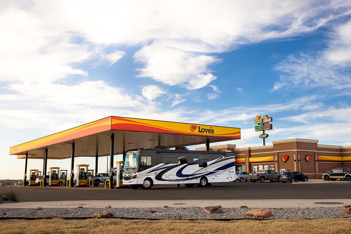
Some truck stops have dump stations also. Flying J, Pilot, Loves, etc. You can use their app to figure out what they have for services.
In your experience, which of the truck stop companies is friendliest to RV's??
 
In your experience, which of the truck stop companies is friendliest to RV's??
I prefer Love’s. IMHO they tend to be cleaner, inside and out, and a little more spread out making access in to and out of the facility easier. I have not used Loves for dumping, but many times for fuel and propane.
Pilots are the worst. They tend to be small and dirty, from what I have experienced.
 
With truck stop camping, your always assumed by truckers to be taking parking spaces away from them.. Not a comfortable position to be in..>>>Dan
 
Last edited:
With truck stop camping, your always assumed by truckers to be taking parking spaces away from them.. Not a comfortable position to be in..>>>Dan
I agree with Dan. I use truck stops for fuel all the time, and we will pull into a parking place for lunch if they aren’t crowded. But I would never spend the night at one. Not only are they noisy and brightly lit, you are taking a spot from someone who really needs it for legal and safety reasons. All you have to do is look around truck stops at all the rigs parked along the side of the road because they couldn’t find a parking spot to tell it isn’t a good idea.
 
I agree with Dan. I use truck stops for fuel all the time, and we will pull into a parking place for lunch if they aren’t crowded. But I would never spend the night at one. Not only are they noisy and brightly lit, you are taking a spot from someone who really needs it for legal and safety reasons. All you have to do is look around truck stops at all the rigs parked along the side of the road because they couldn’t find a parking spot to tell it isn’t a good idea.
I have noticed over the last couple years that Loves is now providing RV spots at some locations, for overnight stays. I even found a Loves RV Park in Salina, Utah. Located across the street from their truck stop. Price was about $10 per night more than two other RV parks nearby but appeared to be much nicer.
 
I have noticed over the last couple years that Loves is now providing RV spots at some locations, for overnight stays.
 
Heed the snow chains required signage when weather is bad. Even if the chaining requirement is not posted you must have snow chains onboard for the passes in California.
My choice is to wait-out weather, it's not worth the risks IMO to push through.
 
Heed the snow chains required signage when weather is bad. Even if the chaining requirement is not posted you must have snow chains onboard for the passes in California.
My choice is to wait-out weather, it's not worth the risks IMO to push through.

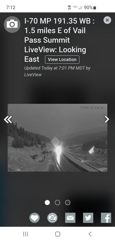
Not the Sierra Nevada Range in California, but in the Colorado Rockies we're currently having winter weather conditions. Carry snow chains.

Screenshot_20231011-191229_Chrome.jpg
 
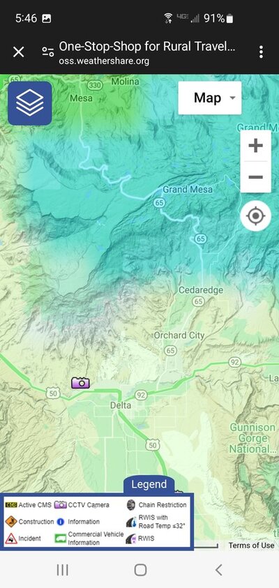
Westernslope; With this website you have access to all weather cameras in the U.S.A.
I haven't even used all the tools and features and still think it's t most useful website I've found for travelers.
One-Stop-Shop for Rural Traveler Information
This resulted from efforts of 7 Western states to assist travelers, that's why there are no cameras East of Kansas.
It must be a bias website due to in the rural region where I reside in Western Colorado there are few to no cameras either.

Is that because it's rural?

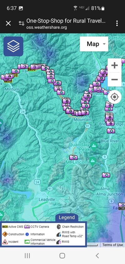
The major ski resorts certainly have lots of cameras along I-70. It really looks stuffed every few yards with cameras. That must be where the money is. Typical Interstate highway funding for Denver traffic priorities.

I'm not surprised that the city of Leadville, Colorado isn't
qualified for any cameras on U.S. Highway 24. The ski resort workers live out there.

Screenshot_20231012-054626_Chrome.jpg
Screenshot_20231012-063701_Chrome.jpg
 
Last edited:
I will add that if you are on an Interstate that is closed due to snow DO NOT try a different route. If the main road isn't clear it is highly unlikely others will be. People have been caught out by this before.
Yes, like every year. Very good advice.
 
Some really nerdy weather sites.

The Forest Service, National Park Service, state parks, and other land agencies maintain a network of Remote Automatic Weather Stations scattered around the country, in remote backcountry areas not covered by regular NWS weather stations in large cities. Used for fire danger and planning purposes. The data from these stations are gathered hourly and available on the internet.


Click on the state, and zoom in to where you want to boondock to see the near real time weather real close to where you intend to camp. Comparing the weather readings to a nearby NWS station will let you fine-tune the regular NWS forecast to your campsite.

Another weather site that lets you zoom in to a specific site is here:


This one is a little finicky and may have to click several times on a particular spot. This site uses an algorithm to estimate the weather at a particular spot, adjusting the area general forecast for altitude and other factors.

For a free on-line reference, sort of a Mountain Weather for Dummies, go here:


Here is a cloud chart, some tips on guessing the weather later today or tomorrow.

 
Last edited:
Some really nerdy weather sites.

The Forest Service, National Park Service, state parks, and other land agencies maintain a network of Remote Automatic Weather Stations scattered around the country, in remote backcountry areas not covered by regular NWS weather stations in large cities. Used for fire danger and planning purposes. The data from these stations are gathered hourly and available on the internet.


Click on the state, and zoom in to where you want to boondock to see the near real time weather real close to where you intend to camp. Comparing the weather readings to a nearby NWS station will let you fine-tune the regular NWS forecast to your campsite.

Another weather site that lets you zoom in to a specific site is here:


This one is a little finicky and may have to click several times on a particular spot. This site uses an algorithm to estimate the weather at a particular spot, adjusting the area general forecast for altitude and other factors.

For a free on-line reference, sort of a Mountain Weather for Dummies, go here:


Here is a cloud chart, some tips on guessing the weather later today or tomorrow.
Good finds
 

Latest posts

Forum statistics

Threads
131,990
Posts
1,388,722
Members
137,736
Latest member
Savysoaker
Back
Top Bottom