AStravelers
Well-known member
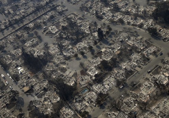
I have always thought about the CA fires as burning homes built in the brush covered hills, probably where they shouldn't have built in the first place. However this time some of the fires are in a neighborhood on flat land, away from brush covered hills.
Take a look at the photo attached, then find the swimming pool in the lower central part of the photo. That pool is at GPS: 38.481756 -122.744164. Copy the GPS and paste it into your smart phone map, Google Maps on your computer, or Google Earth application, select the satellite view and take a look at the subdivision from the sky before the fire. Then zoom out and look at the area. This is a subdivision just like many of us live(d) in.
I guess the fire got started somewhere and jumped from house to house.
The photo was copied from today AP News feed.