Found this simple web site for avoiding mountains

The friendliest place on the web for anyone with an RV or an interest in RVing!
If you have answers, please help by responding to the unanswered posts.
It has possibilities, but, routing leaves a lot to be desired. For instance, I entered begin at Indianpolis IN to West Yellowstone MT.
It routed directly through downtown Chicago, and overnight at the Marshall truck yard near downtown just to eat at a specific restaurant. That is very inconvenient and time consuming.
Yeah i saw that as well when i mapped NC to San Francisco. But it's something and I havent found anything else ... yet
 
My guess is that its literal on the application of *any* altitude advantage, including elevations that are not great like parts of Indiana and Illinois.

My view is that this would be a useful tool for segments of trips, where the start point is more immediate to the next destination and is known to be mountainous.… then drag and drop the route in google maps to match. Thanks for the pointer

** For my last trip out west from metro detroit, I decided to take the SS Badger across Lake Michigan from Ludington to skip driving through Chicago - which I also loathe.
 
The RV Trip Wizard elevation option is far more useful for planning, I think.
This might prove useful with a bit of play time with it.
A project for tonight.
 
Where is the elevation option? I only have the free version for now. I looked on both the app and web site
 
I just entered Lynchburg, VA to Grand Junction, Colorado where will be heading to this weekend.

It took a route directly into the windiest hairpin turns on steep grades narrow 2 lane road through the Blue Ridge Mountains that I've ever towed across (just once). And I thought where we live was bad in the Grand Mesa. It also headed directly into the approximately 11,000 feet high Loveland and Vail mountain summits of the Rockies. No thanks, but thank you for posting. Got to get our 25 foot TT back in 1 piece. We'll be heading around the mountains via Virginia I-81 and later on Wyoming I-80 and down through the high plains to avoid the High Country.
 
I have not yet found a way to make use of this app, other than to see what you have to deal with on a plotted route. It does not offer an easy way to reroute or even select multiple destinations.
The Trip Wizard feature is a lot easier to use. You can re-route on the fly with it fairly easily.
 
It wouldn't be a good start towing out of Virginia following a plotted route given without knowledge of the restrictions. Leaving Lynchburg the narrow highways through the mountains either restricts the length of tractor trailers and/or prohibits all tractor trailer access to use except by VA permit, only. I'll stick with the blue routes in Virginia per the map below since coming out here I was following behind our 33 foot long and 13 foot high toy hauler with lots of corners of which both lanes of the narrowest 2 lane road had to be utilized to make it. The 13 feet 4 inch clearances with no turnaround wasn't foreseen either.

 
Last edited:
That was fun. I put in Westminster, Ca where I live to Portsmouth IA (western Iowa 40 miles from Omaha). It routed me directly over the San Gabriel Mountains then over the Southern Sierras, then directly over the heart of the Rockies through Denver, then down through Nebraska. The intent is to bypass higher elevations, correct?
 
That was fun. I put in Westminster, Ca where I live to Portsmouth IA (western Iowa 40 miles from Omaha). It routed me directly over the San Gabriel Mountains then over the Southern Sierras, then directly over the heart of the Rockies through Denver, then down through Nebraska. The intent is to bypass higher elevations, correct?
It shows elevations encountered and grades. I put in Mesa, Colorado where I live to Cedaredge, Colorado. Both towns are roughly at the same elevations. Highway 65 goes up from Mesa located at approximately 5,638 feet, over the 10,838 foot summit, and then back down the 5,000 feet to Cedaredge in 39 miles. There's a 10,000 feet elevation gain plus loss. Grades are up to 10%. I think that it got both the maximum grade and minimum grades way off, especially the 70% grade. Minimum grade is zero over the top.

Results...

Max elevation: 10838 ft / 3303 m
Min elevation: 5638 ft / 1719 m
Elevation change: 5200 ft / 1585 m
Max grade: 70.6%
Min grade: -10.2%
Steepness score: 156 + 7058 + 30515 + 1 = 37731
Distance: 39.11 mi / 62.95 km
Travel Time: 51 mins
 
Last edited:
I have a TomTom GPS, so I use their app on the laptop to plan my trips. This app takes into account the size and weight of my rig in its routing. It's also easy to add other waypoints to modify the route to go where I want it to.
I never use the exact route it comes up with the first time. Then again, I don't worry about a few hills either. If my rig will summit Wolf Creek Pass in Colorado and Tioga Pass in California (both of which I've done multiple times) then a few little mole hills in the Ozarks or Blue Ridge Mountains aren't going to bother it.
 
Going down from the summit is always my concern more than going up. Especially after learning a lesson about hauling a trailer east over Sonora Pass (California) with its 26% grade.
 
In Google Maps, if you have it plot a route, then select walking instead of driving, it will show a graph of elevation changes below the directions. This is useful for short segments that you know might be an issue and you want to see the elevation change.

Charles
 
We just go over the mountains if we have to in order to get where we're going. So far haven't gotten overheated, but we certainly have to stick to the right-hand lane at times when we drop to ~40 mph behind the big trucks - views are gorgeous from the top and the ride back down can be quite thrilling until you learn to shift down to the gear you were climbing in and how to use your brakes properly to prevent burning them up.

I would imagine the app would be great for truckers that might want to save fuel rather than burn it up on a hill.
 
Going down from the summit is always my concern more than going up. Especially after learning a lesson about hauling a trailer east over Sonora Pass (California) with its 26% grade.

In the 60's my dad and I had a 16' Aristocrat Land Commander towed by a then new '64 Ford F100.
Our favorite place to camp was The Dardanelles which is about 50 miles up the 108 from Sonora. One time we left The Dardanelles headed over the pass towards Nevada. There was a big sign at the bottom of the pass that said "No House Trailers". I pointed that out to my dad, but he said, "This isn't a house trailer, it's a travel trailer". Well, about a 1/4 mile short of the summit that poor old 6cyl, 3-on-the-tree Ford ran out of oomph, and we were stuck...in the middle of the rather narrow highway, blocking traffic in both directions until a tow truck could make it from wherever it came from.
A couple of years later, he tried it again, this time pulling the same trailer with a Toyota Land Cruiser. That thing had 4wd and locking front hubs so you could effectively have 2wd low range. Which is what he had to use to get over the top that time.
Maybe that explains why I'm usually more concerned with the climb instead of the descent. I just drop off the top at a much reduced speed, drop to 2nd gear and don't let my speed climb too high.
My current rig is a 37' gasser pulling an 18' open car hauler, so I have no intentions of ever getting anywhere near Sonora Pass. I've climbed Tioga Pass twice and exited the park through Groveland and down Priest Grade (the new side) to the 49. That was bad enough.
 
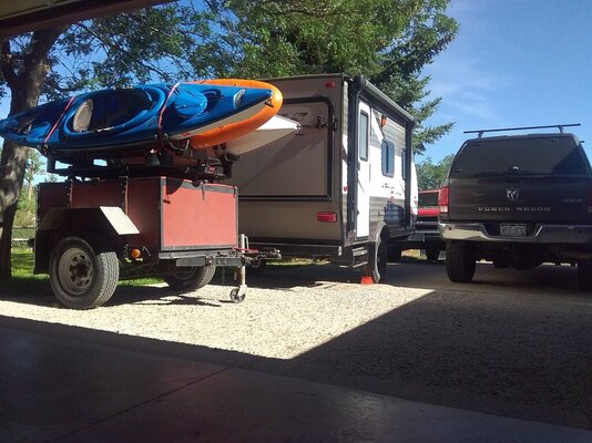
I came down Sonora Pass with a 1984 GMC S15 4x4 Jimmy in the early 1990's. It has a 3.42-1 gear ratio and at the time a 4 speed manual on the floor (replaced it with 5 speed). At the time the road wasn't paved so I kept it in first gear in 4 low in 4 wheel drive. At a 26% grade I still overheated the brakes by tapping them as little as feasible to maintain a safe speed. The trailer I was towing was full of camping gear. I purchased it in 1984 in the Bay Area and it is a 4 by 5 foot utility built in 1960 on the front suspension of a 1941 Chevrolet truck that still has the brake drums on it, but not used for the trailer. The Jimmy still runs and is on a family property in Wyoming. We still use the trailer.
20220806_093847.jpg
 
Back
Top Bottom