Elevation Route Mapping

The friendliest place on the web for anyone with an RV or an interest in RVing!
If you have answers, please help by responding to the unanswered posts.

Henry J Fate

Well-known member
Joined
Jun 14, 2018
Posts
2,292
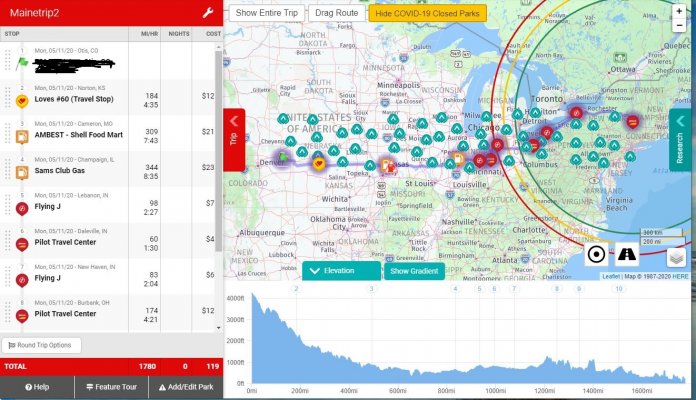
Curios to know what fellow RVers are using for elevation of travel routes.  I currently do not have a good source to get me around mountains especially when towing.

I am basically looking for something that I can look at routes and determine the elevation ups and downs of a route. Is there anything available that offers this? Anything electronic?

Thanks
 
If you use Google maps and road allows cyclists, change your mode to bicycle and it will show you the elevation changes.

I think it works best on laptop or PC as mobile version has less data. I'll see if I can find a previous post I did.

Here it is, click on the picture to see an example.....  good luck!

http://www.rvforum.net/SMF_forum/index.php/topic,127992.msg1172516.html#msg1172516
 
Well thank you Jackie. Yes I do use Google maps and was unaware of the graph generation in the bicycle mode which btw works on my Sony android just fine. I don't think it is flexible enough to rely on as it only graphs a generated bike route which does not include any highways and did not give me any route options beyond what the software generated. Maybe I am not using it properly or missing some options?
 
Henry J Fate said:
Well thank you Jackie. Yes I do use Google maps and was unaware of the graph generation in the bicycle mode which btw works on my Sony android just fine. I don't think it is flexible enough to rely on as it only graphs a generated bike route which does not include any highways and did not give me any route options beyond what the software generated. Maybe I am not using it properly or missing some options?
I guess it depends on how much information you need Henry.  Google shows the amount of height you will gain and lose on a particular route. It does not tell you the gradient.

At the start you pick the route it will show alternatives. It wont show a cycle route on a road that does not allow them I expect. You need to ensure when you change to cycle it has not changed the route because of this.

We use this on occasion to check things.  I think most States have maps showing truck routes, or rather roads which trucks should not use which is obviously useful as it relates to longer vehicles like ours.

Here are links to the ones for California and Washington as examples.

https://dot.ca.gov/programs/traffic-operations/legal-truck-access/truck-network-map

https://www.wsdot.wa.gov/commercialvehicle/restrictions/

If you need something more robust, as the others have stated there are options like Garmin, RV Trip Wizard and I believe a Truckers route guide (I have seen this mentioned on other posts)..

Hope you find something that works for your needs.


I'm also a printed map person.  The AAA maps are very good.  They're easy to read and show passes with their elevations.  The state-produced maps usually show topography but often have so much extraneous stuff that they're hard to read.  I do like them for city maps, however, because they usually show more cities in detail.  The AAA maps also show cities but fewer which may be because they usually have a couple of states, one on each side of the paper.  They often have special inset maps such as for the Yosemite Valley, Lake Shasta or the Smokies.

ArdraF
 
In print there is "Mountains West" and "Mountains East" used by truckers.
Good information on grades etc.
Looks like it's no longer in print.  But here's one on Amazon:

https://www.amazon.com/Mountain-Directory-Motorhome-Locations-Descriptions/dp/0964680513/ref=pd_sbs_14_3/132-8099665-7765037?_encoding=UTF8&pd_rd_i=0964680513&pd_rd_r=6864c8a2-3a6b-4261-81c1-d337bd97bacb&pd_rd_w=GhUcy&pd_rd_wg=mIkfA&pf_rd_p=bdc67ba8-ab69-42ee-b8d8-8f5336b36a83&pf_rd_r=K3FSJ059DTQ4DTTQ71HD&psc=1&refRID=K3FSJ059DTQ4DTTQ71HD

 
This morning I reviewed the instructional videos for rv trip wizard. I did not see anything that displayed the elevation view or option. The videos seemed to be mostly geared for fuel, campgrounds, rest areas etc. I also did not see a setting for towing. No device needed. Just download the app. They do offer a week trial and the year subscription is $39.99.

Garmin videos were listed on the website but none would open the location of the video. It seems that the videos may have been discontinued. There was a support option where you could request instructional videos for a specific device which I did not attempt. There appears to be no free trial and the system requires a dedicated device. I will need to do some additional research with this service.

The other service I looked at was Copilot. I have not finished looking at information about this service but they have been around awhile with varying evaluations. No device is needed and they offer a free trial.
 
Henry J Fate said:
This morning I reviewed the instructional videos for rv trip wizard. I did not see anything that displayed the elevation view or option. The videos seemed to be mostly geared for fuel, campgrounds, rest areas etc. I also did not see a setting for towing. No device needed. Just download the app. They do offer a week trial and the year subscription is $39.99.

Garmin videos were listed on the website but none would open the location of the video. It seems that the videos may have been discontinued. There was a support option where you could request instructional videos for a specific device which I did not attempt. There appears to be no free trial and the system requires a dedicated device. I will need to do some additional research with this service.

The other service I looked at was Copilot. I have not finished looking at information about this service but they have been around awhile with varying evaluations. No device is needed and they offer a free trial.

After you have created a route, there is a link to show elevation of the route.
A blue tag at the bottom that says, "Elevation"
Click and it pulls up an elevation diagram from start to finish

Though, just checking COPilot.
It looks interesting. May have to play with that on next trip.


Attachments

  • Capture.JPG
    Capture.JPG
    339.9 KB · Views: 21
Ya we will probably pull the free trials on both rv trip wizard and copilot since we have 2 phones. We have a 16 day trip coming up and we will use them then.

The other option mentioned here was the paper option. I think I will grab some of those maps to have around. 

For some reason, trip wizard doesn't have a video showing the elevation option. I did not hear it mentioned in any of the videos I watched but maybe I missed it idk. Thanks for the tip on that.

I will do some more research on Garmin. There must be some videos somewhere. It looks like it may be quite popular with 18 wheelers which would seem to be a good thing.
 
Henry have a search here for Garmin, there have been many posts giving model numbers which may help you narrow down what you want. I think the good thing about those is the ability to put in the dimensions of your rig.
 
Garmin elevations are dependant on the particular map you use.  Some do, some do not.  My Garmin, City Navigator (latest versions and others) do not have elevation data included.
 
Henry J Fate said:
Ya we will probably pull the free trials on both rv trip wizard and copilot since we have 2 phones. We have a 16 day trip coming up and we will use them then.

The other option mentioned here was the paper option. I think I will grab some of those maps to have around. 

For some reason, trip wizard doesn't have a video showing the elevation option. I did not hear it mentioned in any of the videos I watched but maybe I missed it idk. Thanks for the tip on that.

I will do some more research on Garmin. There must be some videos somewhere. It looks like it may be quite popular with 18 wheelers which would seem to be a good thing.

You are correct. RVtripwizard did not mention it in any of their vids.
It is just there.
And it just works.
You can explore different routes and get elevation profiles of each. route. It takes more work that I would like, but it came in handy when were were plotting our last trip home from back east and wanted to avoid any major grades.

 
Someone clued me in this week that you can use google earth (PC version not web) and import the geodesic survey (topography) maps as an overlay.

You won't have your route laid out but you can trace your route and see the mile by mile elevation changes on the route.

I haven't messed with this yet or I would provide the details on how to do it but I did see the overlay in action and it is pretty cool.
 
There is an app called mountain directory it gives grade levels of the interstate and highways.
 
Marty1300 said:
There is an app called mountain directory it gives grade levels of the interstate and highways.
There is an East, West and Combined. Looks like electronic versions of the books. Thanks for that Marty1300!
 

Latest posts

Forum statistics

Threads
132,110
Posts
1,390,490
Members
137,830
Latest member
RoadSage
Back
Top Bottom