Looking for route tips/advice, first cross-country drive.

The friendliest place on the web for anyone with an RV or an interest in RVing!
If you have answers, please help by responding to the unanswered posts.
The good news is that your youth means that this will not be your last trip out west. And your route looks a bit better. A couple of suggestions--have you been to White Sands National Monument and Alamogordo? Nice "barefoot" hiking in the soft sands at White Sands. If you go there, I highly recommend Oliver Lee State Park. What about Tucson and the Pima Air Museum and "Boneyard" where they take planes apart. Also excellent Arizona-Sonora Desert Museum.

I have done all of those. I spent a lot of time in NM as a kid. I have done every national park south of my planned route.
 
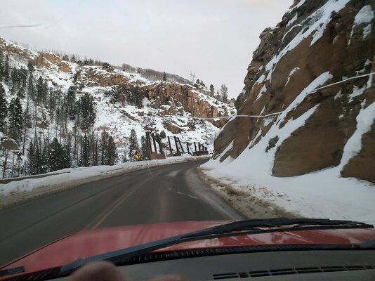
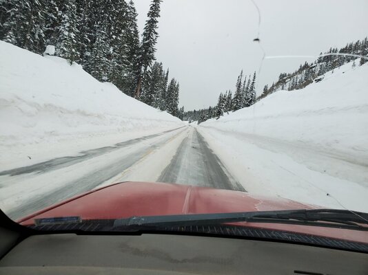
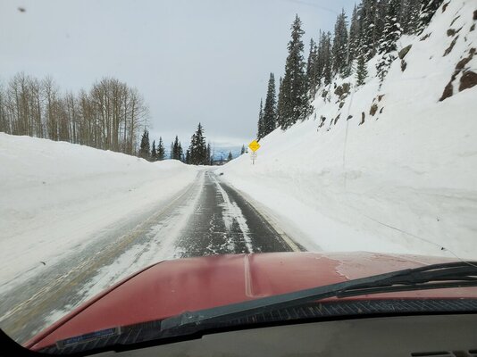
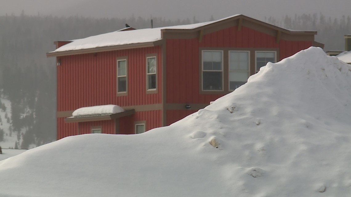
I drove today from Mesa, Colorado to Monarch Pass, Colorado and back. Drove pass the South Rim and North Rim Black Canyon of the Gunnison turn-offs via Highway 50 and 92. While driving I took some photos through my cracked windshield of my old 4x4 truck. Hwy 50 was worked on at mile marker 123 for approximately 6 months. They installed huge fences to stop falling boulders and widened the narrow road in Little Blue Creek Canyon. This is winter here. Snow is over 12 feet deep. Avalanche sign on the last photo. It's not the time to camp in Western Colorado. Good choice.

20230127_071204.jpg
20230127_164507.jpg
20230127_165300.jpg
 
Believe it or not, you can't get to the Sand Dunes without going through a piece of the Rockies, though it's southern Colorado and somewhat lower elevations than going I-70. Nor do I know how you'd get to the Black Canyon of the Gunnison without going through the Rockies.

In fact, if you go through Colorado to any state except Wyoming (staying east of the Rockies), or even appreciably further west than I-25 you cannot avoid some piece of the Rocky Mountains, since they literally run from El Paso, TX (actually from Mexico) through Montana into Canada. Granted that some areas are easier travel than others, though.
Point of fact: The Rocky Mountains end in Northern NM around Santa Fe (Sangre De Cristos). The Sandias (East of Albuquerque) and southern NM mountains are not part of the Rocky Mountains. I went to a lot of Geology classes at UNM :)
 
Either way one has to deal with significant elevation, and associated low temperatures when crossing the "mountain states", at it is common to still have snow on the ground in parts of this region through at least February, and in some parts roads will not even open until as late as June.
 
Getting to the Great Basin, Arches, Bryce, Canyon Country, Capital Reef and the Grand Canyon will require going up to higher elevations. They aren't in Colorado, but they are in the western US. These National Parks are all above 4,000 feet in elevation. Higher elevation can make a difference quickly in snowfall especially when the roads getting there require going over higher summits.

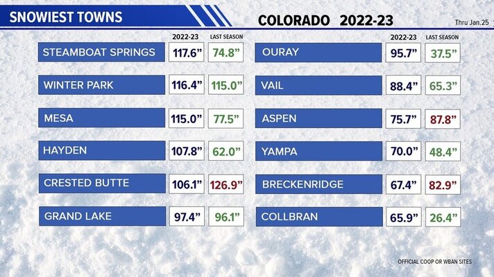
I was asked back in October at a family gathering whether we get much snow. My answer was that we don't get much. We're getting pounded this season. Our little unincorporated community is 3rd for the most snow and it just snowed again this morning. Over 9 feet to date. Parts of the Western US are seeing record snowfalls.

f71c4752-8987-4df0-9b21-348d39f05cb8_1140x641.jpg

 
Point of fact: The Rocky Mountains end in Northern NM around Santa Fe (Sangre De Cristos). The Sandias (East of Albuquerque) and southern NM mountains are not part of the Rocky Mountains. I went to a lot of Geology classes at UNM :)
OK, perhaps the name is different, though I always thought of the Sandias, Manzanos, etc. as part of the Rockies when I lived in Albuquerque, but it's still a continuation of the mountain chain that basically extends from way up in Canada down through the Andes to the foot of South America.
 
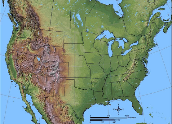
Looking at it from 100,000 feet, Nevada has the most mountain ranges. One summit/pass after another via Highway 50 east to west from Pueblo, Colorado through the High Sierra near Lake Tahoe, California. It really doesn't matter where the Rockies end, the mountains out west are 7,000 feet to 14,000 feet plus high in altitude which get snow in February. Even the flat basins and valleys in-between are 4,000 feet to 10,000 feet in elevation. It's a huge region of mountain chain(s) no matter what's it named.

ShadedRelief.jpg
 
Last edited:
This seems important but I'm not sure what I should do/consider with this information.
  • You will have some long climbs/descents as you cross the southern Rockies
  • Nights especially are colder at higher altitudes, so be prepared.
  • You may notice some loss of engine performance at higher altitudes but it won't be enough to be a concern.
 

Latest posts

Forum statistics

Threads
131,988
Posts
1,388,709
Members
137,736
Latest member
Savysoaker
Back
Top Bottom